
Resultados de la búsqueda
Para más opciones de búsqueda, vea Ayuda:Búsqueda.
Quizás quisiste decir: geodesica satélites
Si consideras que este artículo debería existir, conoces nuestros pilares, dispones de fuentes fiables y sabes indicarlas como referencias, puedes crearlo, opcionalmente usando nuestro asistente.
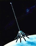
- Ajisai (redirección desde Experimental Geophysical Satellite)lanzamiento, el satélite se llamaba EGS, siglas en inglés para Experimental Geodetic Satellite, una vez en órbita el satélite fue rebautizado. Ajisai tienen un cuerpo…4 kB (412 palabras) - 14:05 24 ene 2024
 Geosat (Geodetic Satellite) es un satélite artificial de la Armada de los Estados Unidos lanzado el 13 de marzo de 1985 mediante un cohete Atlas desde…2 kB (154 palabras) - 11:46 16 ene 2024
 PAGEOS (Por sus siglas en inglés "PAssive Geodetic Earth Orbiting Satellite") fue un satélite aerostático lanzado por la NASA en junio de 1966.[1] Pageos…5 kB (487 palabras) - 12:16 4 sep 2022
- observations o flow inclination satellites, DIAL, SAS & PEOPLE; G eophysical Monograph Series 15 AGU "The Use of Artificial Satellites for Geodesy", 1972 Miembro…44 kB (6712 palabras) - 19:28 28 jul 2023
 DGPS Performance in the Position and Pseudorange Domains». Bulletin of Geodetic Sciences 25 (4). «Statement by the President regarding the United States'…6 kB (744 palabras) - 21:38 8 oct 2023
 Centro de Predicción de Tormentas National Ocean Service (NOS) National Geodetic Survey (NGS) Office of Coast Survey (OCS) Office of Response and Restoration…18 kB (1774 palabras) - 08:08 29 feb 2024
 separado una distancia de 5 dm Receptor GPS de 12 canales con calidad geodética Retroreflector láser El satélite GOCE fue lanzado a las 14:21 GMT del…6 kB (599 palabras) - 17:06 28 ene 2024
 A. I. Zakharov, "The Rotation Period, Direction of the North Pole, and Geodetic Control Network of Venus," Journal of Geophysical Research, Vol. 97, £8…9 kB (1077 palabras) - 19:57 27 oct 2023
 Maryland 1970. mit K. R. Koch: Geodetic Data. American Institute of Physics Handbook. New York 1972. A worldwide Network of Satellite Triangulation. In: Journal…8 kB (1018 palabras) - 19:06 17 feb 2024
 Seeber (2008), Satellite Geodesy, Walter de Gruyter, 608 pages. [2] NIMA Technical Report TR8350.2, "Department of Defense World Geodetic System 1984, Its…31 kB (3555 palabras) - 11:10 31 may 2024
- Space Flight Center Explorer Program Satellites por el National Space Science Data Center SMEX-series satellites por Colorado State University NASA Explorers…38 kB (1689 palabras) - 19:54 20 nov 2023
 Geometric Geodesy, Part I (en inglés). Ohio State University Department of Geodetic Science and Surveying. Snyder, John P (1993). Flattening the Earth: Two…19 kB (2446 palabras) - 15:06 21 may 2024
 NAVD88 Elevation with the GEOID96 Geoid Height Model» (en inglés). National Geodetic Survey, NOAA. Consultado el 7 de marzo de 2007. Sandwell, D. T.; Smith…170 kB (17 913 palabras) - 11:48 7 jun 2024
 «Artificial satellites». Science Learning Hub (en inglés). Consultado el 13 de abril de 2023. «Satellite Technology: How big is a Satellite?». National…190 kB (21 258 palabras) - 20:36 4 jun 2024


