
Archivo:East Branch Clarion River Lake at Elk State Park.jpg
Tamaño de esta previsualización: 800 × 600 píxeles. Otras resoluciones: 320 × 240 píxeles · 640 × 480 píxeles · 1024 × 768 píxeles · 1280 × 960 píxeles · 2304 × 1728 píxeles.
Ver la imagen en su resolución original (2304 × 1728 píxeles; tamaño de archivo: 1,28 MB; tipo MIME: image/jpeg)
Resumen
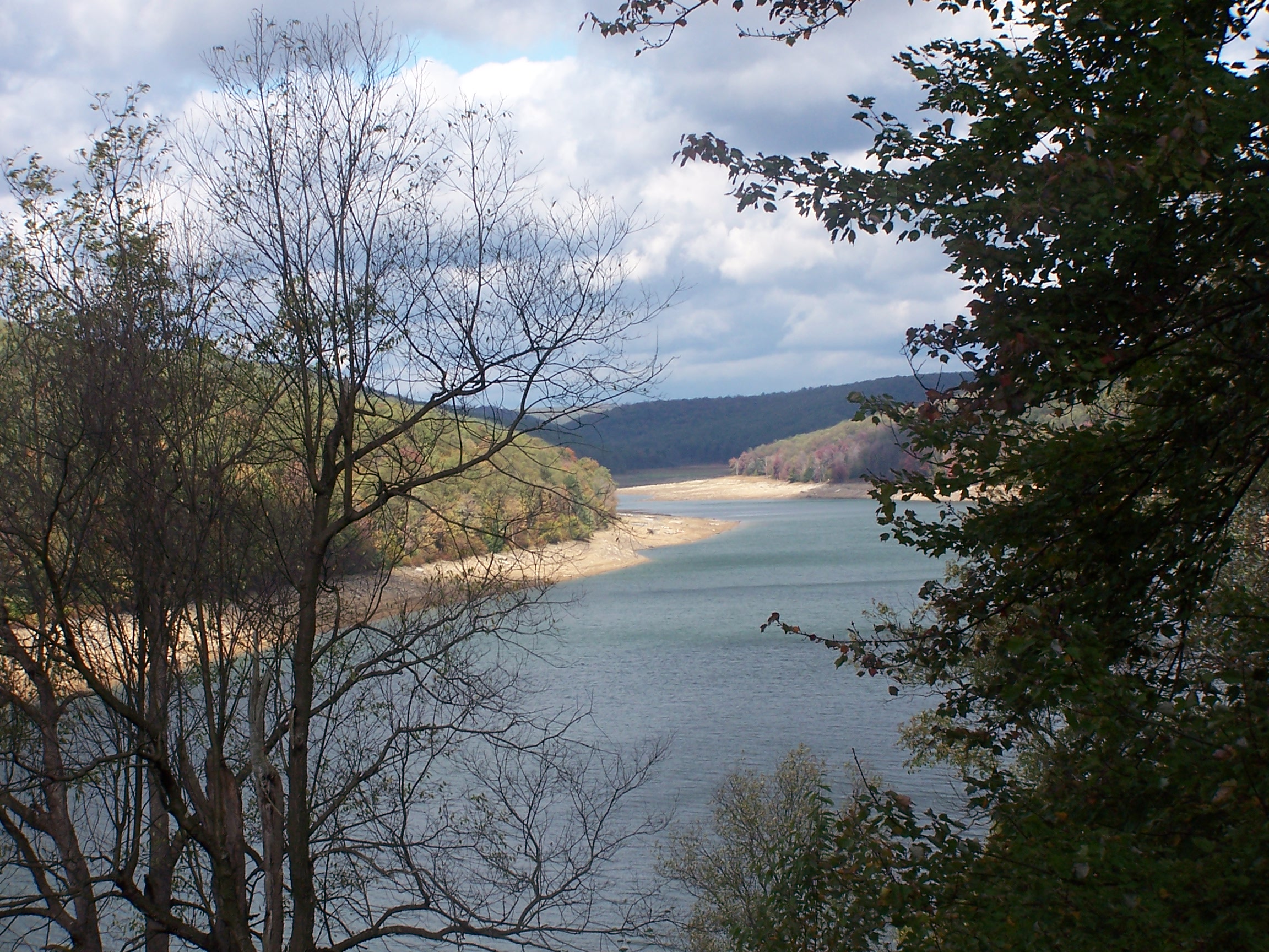
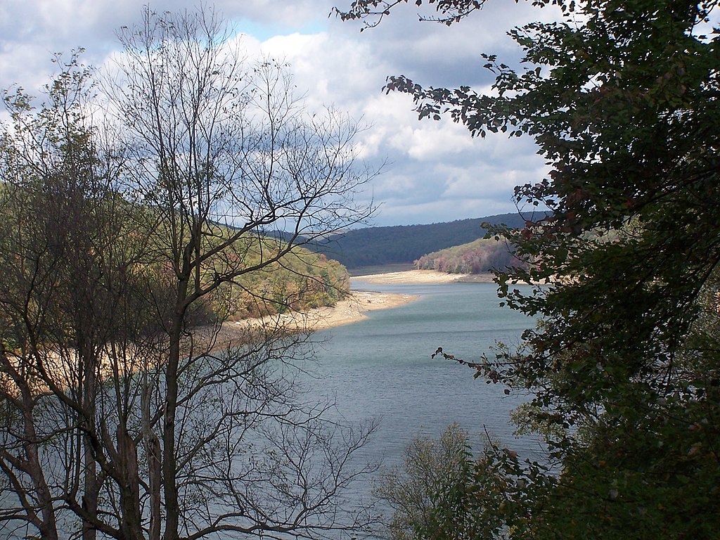
| Descripción | The level of this reservoir varies widely in its function as a flood control for the Clarion & Allegheny Rivers. Under the water at just about the point it disappears around the bend is the town of Instanter. From the late 19th c until the 1920s, this area was nearly clearcut of hemlock - just to get the chemicals out of its bark. Location for this photo reached by driving twelve miles on unpaved roads and walking four miles more. Interestingly, when I located this on the Flickr map, it self identified as Instanter, which I did not know was still used as a geographical location. |
| Fecha | |
| Fuente | east branch reservoir elk county pa |
| Autor | Tim Engleman |
Licencia
Este archivo se encuentra bajo la licencia Creative Commons Genérica de Atribución/Compartir-Igual 2.0.
- Eres libre:
- de compartir – de copiar, distribuir y transmitir el trabajo
- de remezclar – de adaptar el trabajo
- Bajo las siguientes condiciones:
- atribución – Debes otorgar el crédito correspondiente, proporcionar un enlace a la licencia e indicar si realizaste algún cambio. Puedes hacerlo de cualquier manera razonable pero no de manera que sugiera que el licenciante te respalda a ti o al uso que hagas del trabajo.
- compartir igual – En caso de mezclar, transformar o modificar este trabajo, deberás distribuir el trabajo resultante bajo la misma licencia o una compatible como el original.
| Esta imagen fue publicada en Flickr por shadysidelantern en https://www.flickr.com/photos/92934406@N00/1591200427. La imagen fue revisada el 30 de octubre de 2007 por el robot FlickreviewR y confirmó tener licencia bajo los términos de cc-by-sa-2.0. |
Historial del archivo
Haz clic sobre una fecha y hora para ver el archivo tal como apareció en ese momento.
| Fecha y hora | Miniatura | Dimensiones | Usuario | Comentario | |
|---|---|---|---|---|---|
| actual | 03:23 29 may 2012 | | 2304 × 1728 (1,28 MB) | Ruhrfisch | Original size version of current photo, all other information is the same |
| 22:03 29 oct 2007 |  | 500 × 375 (185 kB) | Gerry D | {{Information |Description= The level of this reservoir varies widely in its function as a flood control for the Clarion & Allegheny Rivers. Under the water at just about the point it disappears around the bend is the town of Instanter. From the late 19 |
Usos del archivo
La siguiente página usa este archivo:
Uso global del archivo
Las wikis siguientes utilizan este archivo:
- Uso en ceb.wikipedia.org
- Uso en cy.wikipedia.org
- Uso en en.wikipedia.org
- Uso en fr.wikipedia.org
- Uso en uk.wikipedia.org
- Uso en ur.wikipedia.org
- Uso en vi.wikipedia.org
- Uso en www.wikidata.org