
Archivo:Africa-countries-northern.png
No se dispone de una resolución más alta.
Africa-countries-northern.png (360 × 392 píxeles; tamaño de archivo: 10 kB; tipo MIME: image/png)

|
File:Africa-countries-northern.svg es una versión vectorial de este archivo. Debería usarse esa versión en lugar de este archivo PNG, cuando sea mejor.
File:Africa-countries-northern.png → File:Africa-countries-northern.svg
Para más información, lee Ayuda:SVG. |
 |
Resumen
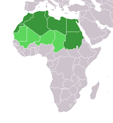
English: Map of countries in geo-political North Africa — as considered by the U.N.
- Credits
from en:Image:Africa-countries-northern.png

|
Se autoriza la copia, distribución y modificación de este documento bajo los términos de la licencia de documentación libre GNU, versión 1.2 o cualquier otra que posteriormente publique la Fundación para el Software Libre; sin secciones invariables, textos de portada, ni textos de contraportada. Se incluye una copia de la dicha licencia en la sección titulada Licencia de Documentación Libre GNU. |
| Este archivo se encuentra bajo la licencia Creative Commons Genérica de Atribución/Compartir-Igual 3.0. | ||
| ||
| Esta etiqueta de licencia fue agregada a este archivo como parte de la actualización de la licencia GFDL. |
Historial del archivo
Haz clic sobre una fecha y hora para ver el archivo tal como apareció en ese momento.
| Fecha y hora | Miniatura | Dimensiones | Usuario | Comentario | |
|---|---|---|---|---|---|
| actual | 15:22 17 mar 2018 | | 360 × 392 (10 kB) | Maphobbyist | Montenegro border |
| 21:00 31 mar 2016 |  | 360 × 392 (10 kB) | Fry1989 | Reverted to version as of 16:12, 13 January 2014 (UTC) | |
| 09:37 7 nov 2015 |  | 360 × 392 (10 kB) | Hpyounes | correction | |
| 16:12 13 ene 2014 |  | 360 × 392 (10 kB) | VVVF | See http://unstats.un.org/unsd/methods/m49/m49regin.htm | |
| 15:59 13 ene 2014 |  | 360 × 392 (13 kB) | VVVF | Reverted to version as of 20:15, 9 July 2011. See http://unstats.un.org/unsd/methods/m49/m49regin.htm | |
| 12:47 20 jul 2011 |  | 360 × 392 (7 kB) | Kahusi | See http://unstats.un.org/unsd/methods/m49/m49regin.htm | |
| 20:15 9 jul 2011 |  | 360 × 392 (13 kB) | Maphobbyist | South Sudan has become independent on July 9, 2011. Sudan and South Sudan are shown with the new international border between them. | |
| 11:13 5 may 2006 |  | 360 × 392 (4 kB) | Hautala | optimized with png | |
| 16:30 20 abr 2005 |  | 360 × 392 (14 kB) | Yonghokim | map of countries in Northern Africa. from en:Image:Africa-countries-northern.png {{GFDL}} |
Usos del archivo
La siguiente página usa este archivo:
Uso global del archivo
Las wikis siguientes utilizan este archivo:
- Uso en ce.wikipedia.org
- Uso en fr.wikipedia.org
- Uso en he.wikipedia.org
- Uso en ru.wikipedia.org
- Uso en sc.wikipedia.org
- Uso en sv.wikinews.org