
Archivo:Adams Block (Crawford, NE).JPG

Ver la imagen en su resolución original (3620 × 2580 píxeles; tamaño de archivo: 1,74 MB; tipo MIME: image/jpeg)
.JPG?uselang=es)
Resumen
| Descripción |
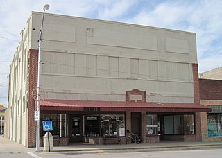
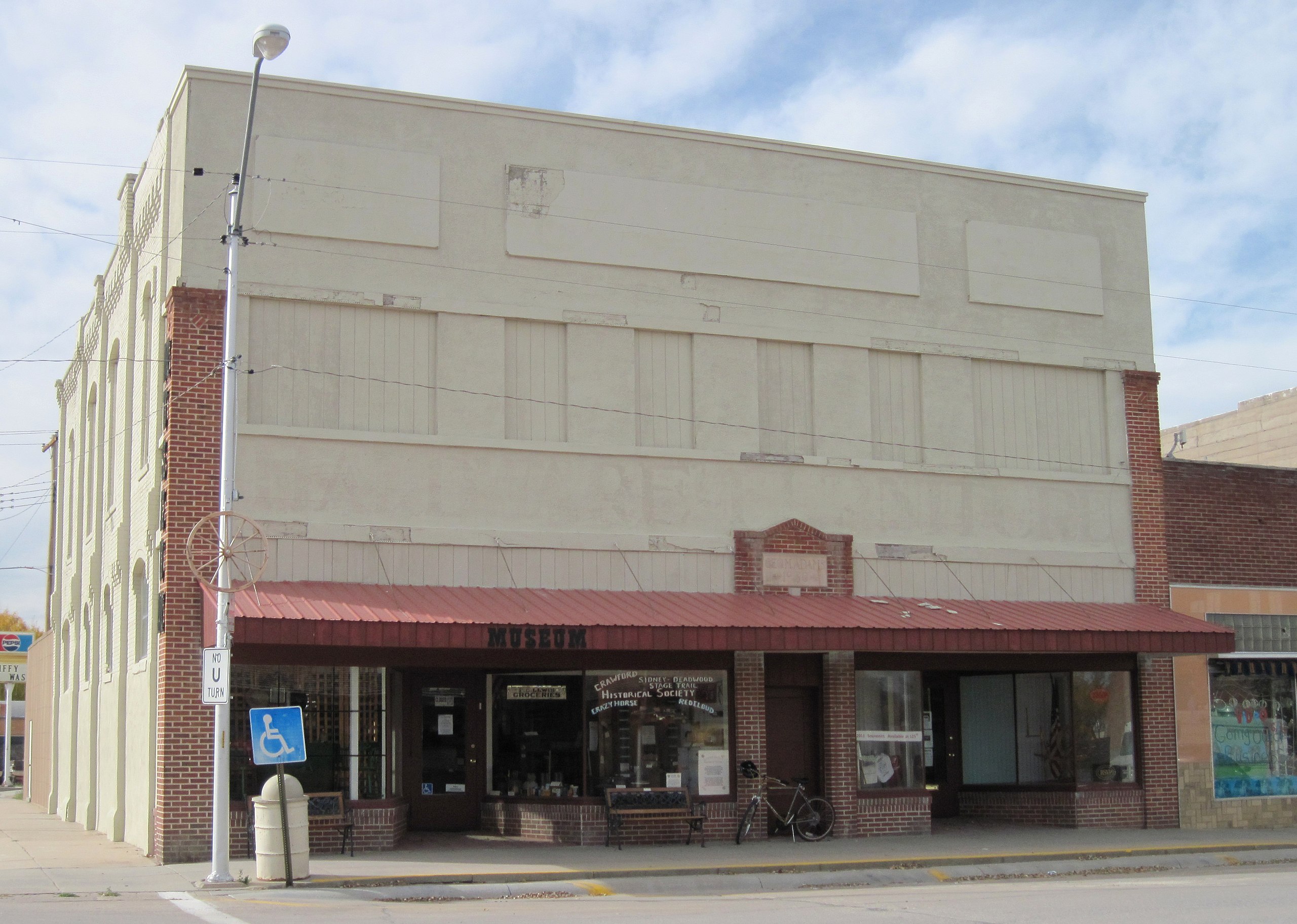
English: Exterior of the Adams Block in downtown Crawford, Nebraska. The edifice was built in 1887, making it the oldest brick structure and one of the oldest buildings in the city. The structure occupies two lots on the northwest corner of Second & Elm Streets. It was refronted in 1930, hence the problematic stucco. The brick on the side of the building is original, however.
The south (left) side of the building housed a hardware store for about 90 years and the north side housed a general merchandise establishment before becoming a furniture store. The upper story was used for offices and "gentlemen's entertainment". However, the upstairs was never updated for electricity or running water and was later used for storing the furniture store's surplus goods. The structure was purchased by the Crawford Cultural Center group in the 1970s. The north (right) side of the building was occupied by Crawford RSVP (which still uses the space, as of 2012), and the south side was used as the senior center before being utilized in 1991 as the Crawford Historical Museum (also still active), run by the Crawford Historical Society. Although the lower story has been kept up fairly well, the upstairs has fallen into a state of dilapidation due to neglect; however, the windows and access door have been closed up to prevent further damage. The additions on the rear of the building, constructed probably about 1910, are used for storage. Surprisingly, the structure does not have a basement. The Adams Block is now owned by the city, which is housed across the street behind the bank. Both organizations currently occupying the building remain active. |
| Fecha | |
| Fuente | Trabajo propio |
| Autor | Chevsapher |
| Posición de la cámara | | Ubicación de esta y otras imágenes en: OpenStreetMap |
|---|
.JPG¶ms=042.685833_N_-103.413333_E_globe:Earth_type:camera_region:US_&language=es)
Licencia
| Este archivo está disponible bajo la licencia Creative Commons Dedicación de Dominio Público CC0 1.0 Universal. | |
| La persona que ha asociado una obra a este documento lo dedica al dominio público mediante la cesión mundial de sus derechos bajo la ley de derechos de autor y todos los derechos legales adyacentes propios de dicha, en el ámbito permitido por ley. Puedes copiar, modificar, distribuir y reproducir el trabajo, incluso con objetivos comerciales, sin pedir aprobación del autor.
|
| Annotations | This image is annotated: View the annotations at Commons |
.JPG)
Historial del archivo
Haz clic sobre una fecha y hora para ver el archivo tal como apareció en ese momento.
| Fecha y hora | Miniatura | Dimensiones | Usuario | Comentario | |
|---|---|---|---|---|---|
| actual | 20:17 29 abr 2012 | | 3620 × 2580 (1,74 MB) | Chevsapher |
Usos del archivo
No hay páginas que enlacen a este archivo.
Uso global del archivo
Las wikis siguientes utilizan este archivo:
- Uso en en.wikipedia.org
- Uso en en.wikivoyage.org
- Uso en pt.wikivoyage.org
.JPG)