
Archivo:USACE Great Salt Plains Dam.jpg
Tamaño de esta previsualización: 800 × 528 píxeles. Otras resoluciones: 320 × 211 píxeles · 640 × 422 píxeles · 1024 × 676 píxeles · 1500 × 990 píxeles.
Ver la imagen en su resolución original (1500 × 990 píxeles; tamaño de archivo: 206 kB; tipo MIME: image/jpeg)
| Descripción |
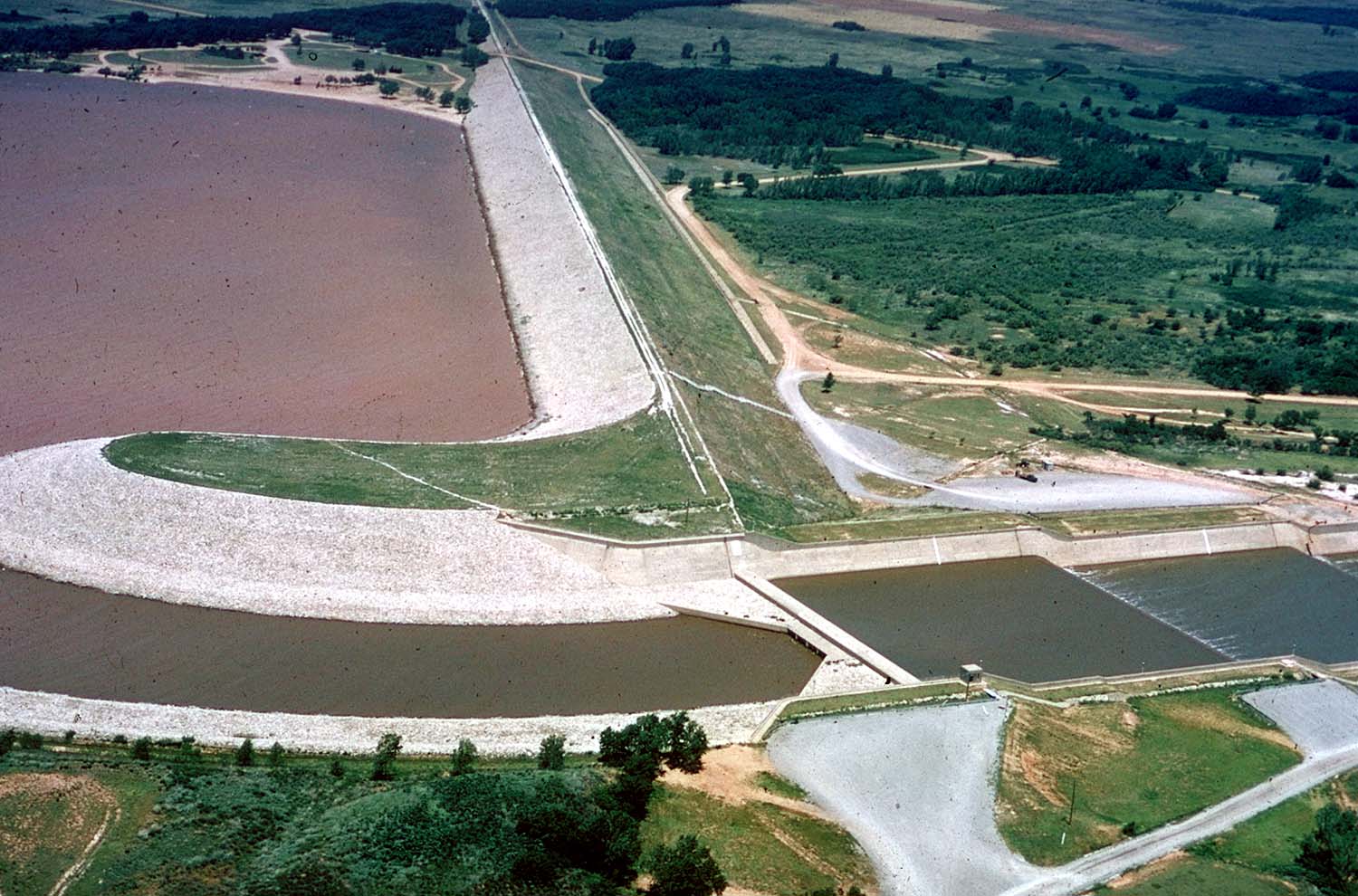
English: Aerial view of Great Salt Plains Lake Dam on the Salt Fork Arkansas River in Alfalfa County, Oklahoma, USA. The dam was constructed by the U.S. Army Corps of Engineers for flood control and water storage. The Great Salt Plains State Park surrounds the dam. View is to the northwest.
Coordinates: 36°44′54.15″N 98°8′20.64″W / 36.748375°N 98.1390667°W |
|||
| Localización | Alfalfa County, Oklahoma, USA | |||
| Fecha | ||||
| Fuente |
U.S. Army Corps of Engineers Digital Visual Library Image page Image description page Digital Visual Library home page |
|||
| Autor | Cheryl Payton, U.S. Army Corps of Engineers | |||
| Permiso (Reutilización de este archivo) |
|
Historial del archivo
Haz clic sobre una fecha y hora para ver el archivo tal como apareció en ese momento.
| Fecha y hora | Miniatura | Dimensiones | Usuario | Comentario | |
|---|---|---|---|---|---|
| actual | 16:35 6 may 2007 | | 1500 × 990 (206 kB) | DanMS | {{Information | Description = {{en|Aerial view of Great Salt Plains Lake Dam on the Salt Fork Arkansas River in Alfalfa County, Oklahoma, USA. The dam was constructed by the U.S. Army Corps of Engineers for flood control and water storage. The Great Sa |
Usos del archivo
La siguiente página usa este archivo:
Uso global del archivo
Las wikis siguientes utilizan este archivo:
- Uso en en.wikipedia.org
- Uso en ja.wikipedia.org
- Uso en www.wikidata.org