
Archivo:Pinckney's Treaty line 1795.png
Tamaño de esta previsualización: 711 × 599 píxeles. Otras resoluciones: 285 × 240 píxeles · 570 × 480 píxeles · 911 × 768 píxeles · 1164 × 981 píxeles.
Ver la imagen en su resolución original (1164 × 981 píxeles; tamaño de archivo: 707 kB; tipo MIME: image/png)
Resumen
| Descripción |
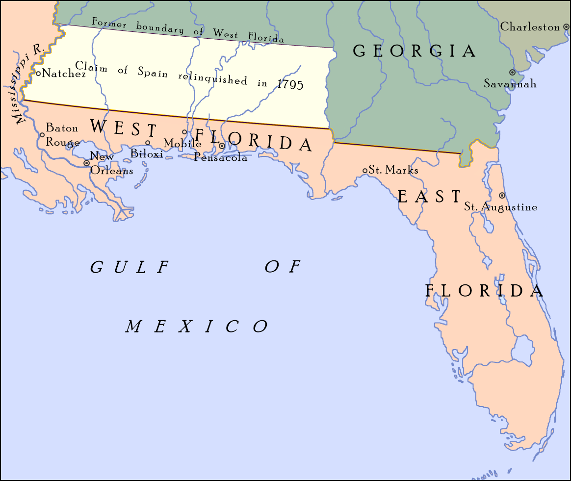
English: Map showing the boundary between the United States and Spanish Florida as set by "Pinckney's Treaty"—signed on October 27, 1795 and became effective on August 3, 1796—at 31°N; also shown is the portion of Spanish West Florida between 31°N and 32° 22′, which Spain relinquished its claim to in the treaty. On April 7, 1798, Congress organized the region as the Mississippi Territory.[1] |
| Fecha | |
| Fuente |
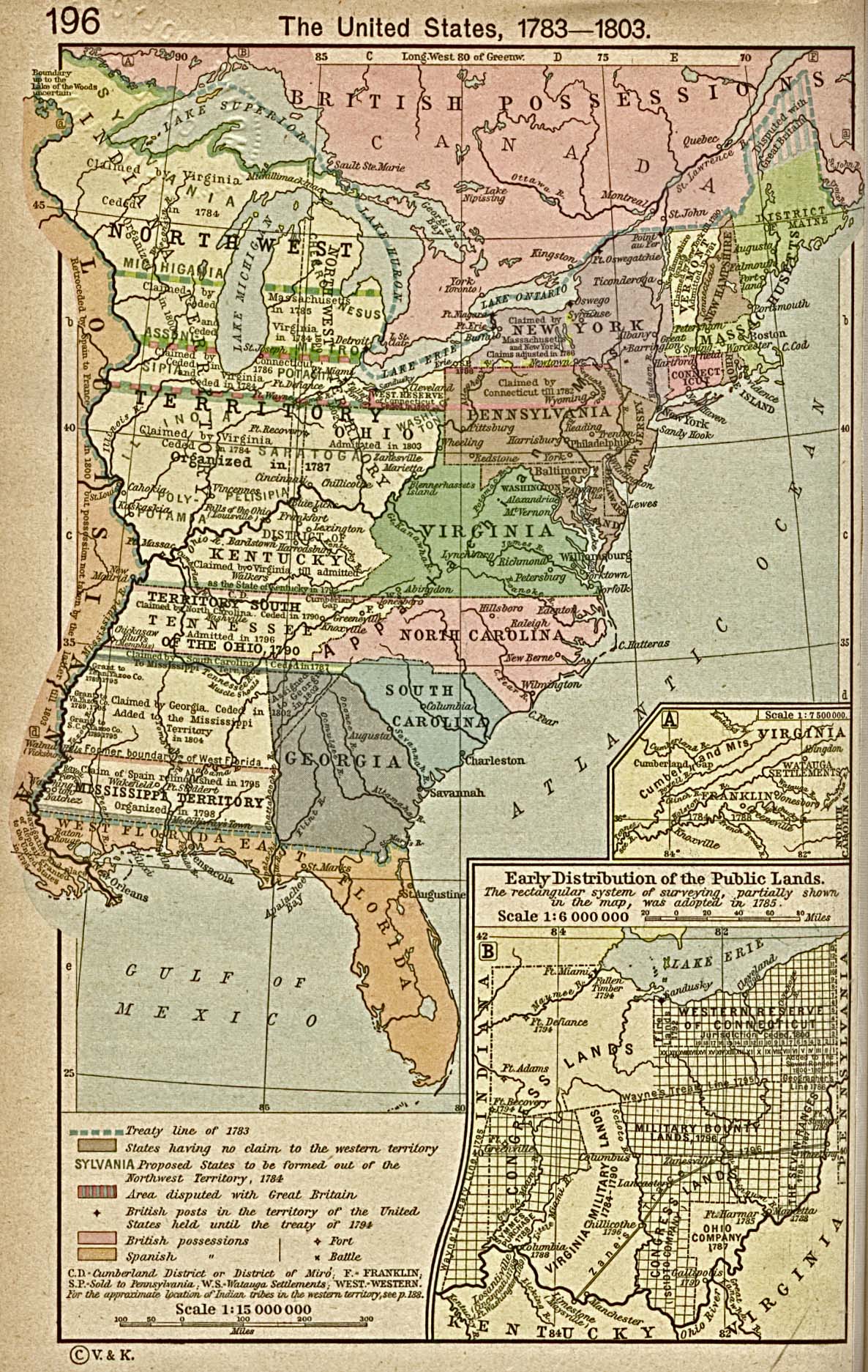
Trabajo propio; map detail from The United States, 1783–1803, Perry-Castañeda Library Map Collection: Historical Maps of the United States, Perry-Castañeda Library, The University of Texas at Austin |
| Autor | Drdpw |
Licencia
Yo, el titular de los derechos de autor de esta obra, la publico en los términos de la siguiente licencia:
Este archivo está disponible bajo la licencia Creative Commons Atribución-CompartirIgual 4.0 Internacional.
- Eres libre:
- de compartir – de copiar, distribuir y transmitir el trabajo
- de remezclar – de adaptar el trabajo
- Bajo las siguientes condiciones:
- atribución – Debes otorgar el crédito correspondiente, proporcionar un enlace a la licencia e indicar si realizaste algún cambio. Puedes hacerlo de cualquier manera razonable pero no de manera que sugiera que el licenciante te respalda a ti o al uso que hagas del trabajo.
- compartir igual – En caso de mezclar, transformar o modificar este trabajo, deberás distribuir el trabajo resultante bajo la misma licencia o una compatible como el original.
- ↑ Pinckney's Treaty Encyclopedia Britannica
Historial del archivo
Haz clic sobre una fecha y hora para ver el archivo tal como apareció en ese momento.
| Fecha y hora | Miniatura | Dimensiones | Usuario | Comentario | |
|---|---|---|---|---|---|
| actual | 20:59 8 ago 2017 | | 1164 × 981 (707 kB) | Drdpw | User created page with UploadWizard |
Usos del archivo
No hay páginas que enlacen a este archivo.
Uso global del archivo
Las wikis siguientes utilizan este archivo:
- Uso en en.wikipedia.org
- Uso en fr.wikipedia.org
- Uso en he.wikipedia.org
- Uso en it.wikipedia.org
- Uso en mt.wikipedia.org
- Uso en pt.wikipedia.org
- Uso en ru.wikipedia.org
- Uso en vi.wikipedia.org