
Archivo:PikiWiki Israel 16194 kiryat gat.jpg

Tamaño de esta previsualización: 799 × 599 píxeles. Otras resoluciones: 320 × 240 píxeles · 640 × 480 píxeles · 1024 × 768 píxeles · 1280 × 960 píxeles · 1682 × 1262 píxeles.
Ver la imagen en su resolución original (1682 × 1262 píxeles; tamaño de archivo: 2,83 MB; tipo MIME: image/jpeg)
| Descripción |
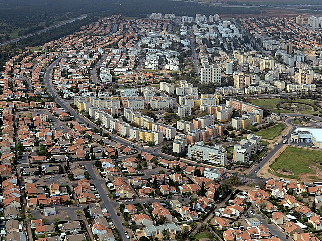
English: kiryat gat, Geography of Israel עברית: תצלום אווירי על הצד המערבי של העיר קרית גת, Original Image Name:תצלום אווירי, Location:קרית גת |
| Fecha | hacia 2010 |
| Fuente | Lehava Center Qiryat Gat via the PikiWiki - Israel free image collection project |
| Autor | ארכיון קרית גת |
| Permiso (Reutilización de este archivo) |
Este archivo está disponible bajo la licencia Creative Commons Reconocimiento 2.5 Genérica. Atribución: ארכיון קרית גת
|

|
This file has been submitted through the Israeli Pikiwiki project and uploaded here automatically.
The project is cooperation between the Israel Internet Association and Wikimedia Israel in an effort to promote the concept of free content on the Web, by creating an image collection of digital-format, good quality photographs, documenting events relating to the history of Israel, or depicting places of distinction in Israel and the Middle East. The Pikiwiki Project is managed from 2021 by the "Heritage Stones" group.
Please consider notifying the project before renaming or deleting this file. Further information about the project can be found on the commons-l mailing list.
|
Historial del archivo
Haz clic sobre una fecha y hora para ver el archivo tal como apareció en ese momento.
| Fecha y hora | Miniatura | Dimensiones | Usuario | Comentario | |
|---|---|---|---|---|---|
| actual | 13:13 1 ene 2012 | | 1682 × 1262 (2,83 MB) | Pikiwikisrael | {{Information |Description={{en|kiryat gat, Geography of Israel}} {{he|תצלום אווירי על הצד המערבי של העיר קרית גת, Original Image Name:תצלום אווירי, Location:קרית גת}} |Source=Lehava Center Qiryat Gat vi |
Usos del archivo
La siguiente página usa este archivo:
Uso global del archivo
Las wikis siguientes utilizan este archivo:
- Uso en ar.wikipedia.org
- Uso en arz.wikipedia.org
- Uso en ca.wikipedia.org
- Uso en ceb.wikipedia.org
- Uso en el.wikipedia.org
- Uso en en.wikipedia.org
- Uso en fa.wikipedia.org
- Uso en fi.wikipedia.org
- Uso en he.wikipedia.org
- Uso en hi.wikipedia.org
- Uso en hy.wikipedia.org
- Uso en id.wikipedia.org
- Uso en ie.wikipedia.org
- Uso en it.wikipedia.org
- Uso en ja.wikipedia.org
- Uso en ka.wikipedia.org
- Uso en ko.wikipedia.org
- Uso en mn.wikipedia.org
- Uso en nl.wikipedia.org
- Uso en nn.wikipedia.org
- Uso en no.wikipedia.org
- Uso en pnb.wikipedia.org
- Uso en ru.wikipedia.org
- Uso en simple.wikipedia.org
- Uso en sr.wikipedia.org
- Uso en ta.wikipedia.org
- Uso en tr.wikipedia.org
- Uso en uk.wikipedia.org
- Uso en ur.wikipedia.org
- Uso en www.wikidata.org
- Uso en yi.wikipedia.org
- Uso en zh.wikipedia.org