
Archivo:NE-districts-109.gif
No se dispone de una resolución más alta.
NE-districts-109.gif (588 × 450 píxeles; tamaño de archivo: 32 kB; tipo MIME: image/gif)
Resumen
| Descripción |
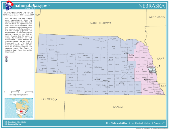
English: Map of Congressional Districts in the state of Nebraska. |
| Fecha | |
| Fuente | National Atlas of the United States (http://nationalatlas.gov/printable/congress.html) |
| Autor | Department of the Interior |
Licencia
This map was obtained from an edition of the National Atlas of the United States. Like almost all works of the U.S. federal government, works from the National Atlas are in the public domain in the United States.
Online access: NationalAtlas.gov | 1970 print edition: Library of Congress, Perry-Castañeda Library
|
Historial del archivo
Haz clic sobre una fecha y hora para ver el archivo tal como apareció en ese momento.
| Fecha y hora | Miniatura | Dimensiones | Usuario | Comentario | |
|---|---|---|---|---|---|
| actual | 16:18 6 ene 2006 | | 588 × 450 (32 kB) | Swid | {{PD-USGov-Atlas}} Category:Nebraska |
Usos del archivo
No hay páginas que enlacen a este archivo.
Uso global del archivo
Las wikis siguientes utilizan este archivo:
- Uso en ja.wikipedia.org