
Archivo:Map of the route followed by by the SS Manhattan to traverse the Northwest Passage.png
Ver la imagen en su resolución original (1601 × 726 píxeles; tamaño de archivo: 511 kB; tipo MIME: image/png)
Resumen
| Descripción |
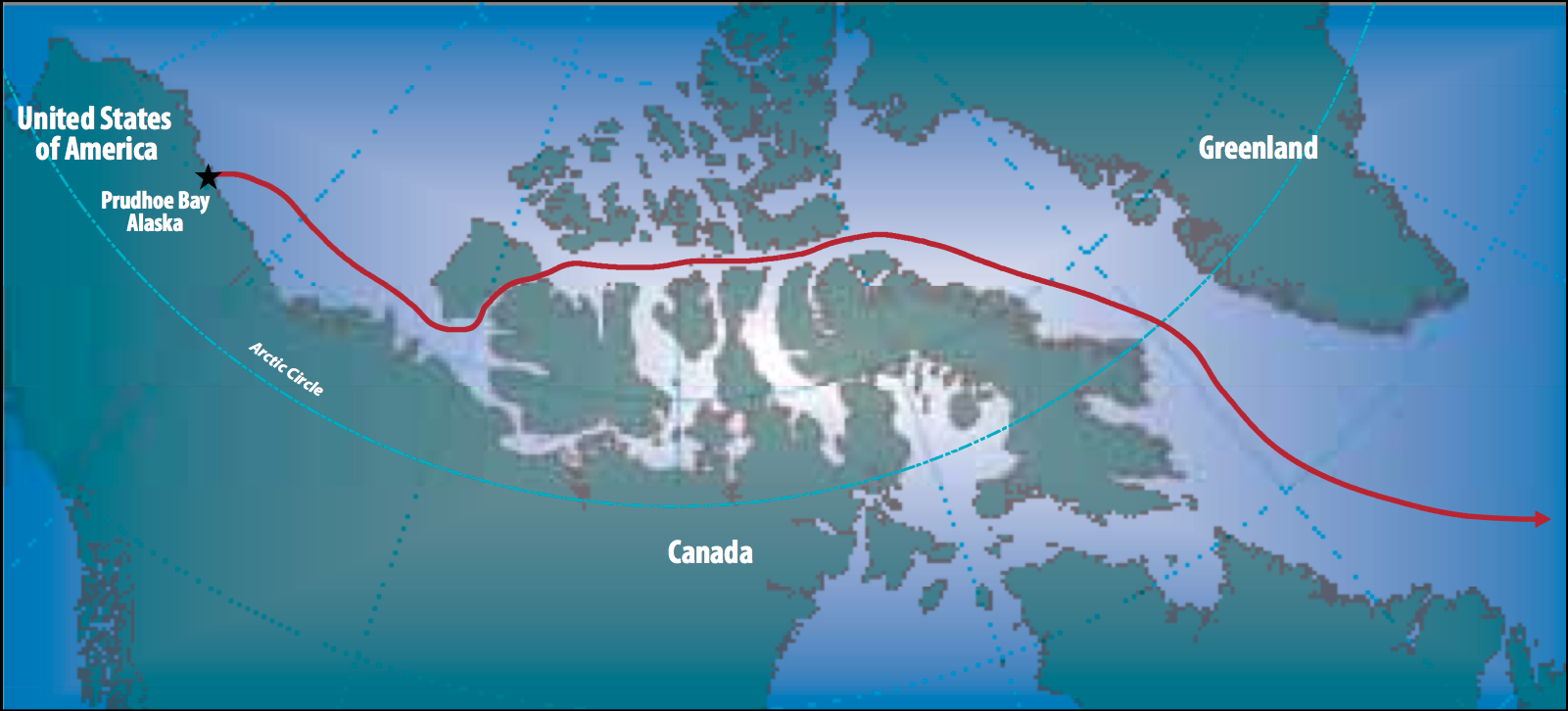
English: Map of the route followed by by the SS Manhattan to traverse the Northwest Passage in 1969. It was the first commercial voyage through the Northwest Passage|Northwest Passage.
In 1969, four shipyards, an international team of maritime experts and three major oil companies pitted their considerable technical, creative and financial resources together to attain the goal of taking a tanker through the infamous NWP. For this voyage the Manhattan had to undergo extensive refit to convert this merchant vessel into an icebreaking tanker. The conversion, lasting eight months (from December 1968 to August 1969) with work being split among four shipyards, cost $US28 million (the entire experiment, with two test voyages originally estimated at $US10-15 million, eventually ended up, 21 months later, costing $US58 million). The Manhattan set sail in August of 1969 with 126 on board (45 crew members, journalists, U.S. politicians, Canadian parliamen- tarians, scientists, naval architects, marine engineers, etc.) for the 4,400-mile journey. Of key importance and significance were the escorting icebreakers accompanying the Manhattan, especially the Canadian icebreakers John A. MacDonald and later the Louis S. St. Laurent. In this voyage the Manhattan was successful as a large model test ship, as the vessel broke thicker ice than any ship in history. |
| Fecha | |
| Fuente | Arctic Council - Arctic marine shipping assessment (AMSA) - http://www.arctic.noaa.gov/detect/documents/AMSA_2009_Report_2nd_print.pdf |
| Autor | Susie Harder |
Licencia
Este fichero se encuentra en dominio público porque the work was created/published by the Arctic Council, an international organization
En algunos países esto no es legalmente posible, en ese caso: ¡Por favor, verifique que la razón dada arriba es válida!
|
Historial del archivo
Haz clic sobre una fecha y hora para ver el archivo tal como apareció en ese momento.
| Fecha y hora | Miniatura | Dimensiones | Usuario | Comentario | |
|---|---|---|---|---|---|
| actual | 18:21 19 oct 2014 | | 1601 × 726 (511 kB) | Al83tito | User created page with UploadWizard |
Usos del archivo
La siguiente página usa este archivo:
Uso global del archivo
Las wikis siguientes utilizan este archivo:
- Uso en en.wikipedia.org