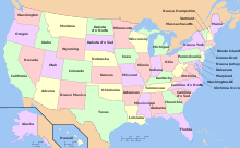
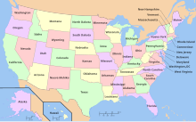
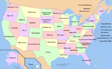
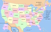
Archivo:Map of USA with state names es.svg
Contenido de la página no disponible en otros idiomas.
De Wikipedia, la enciclopedia libre

Ver la imagen en su resolución original((Imagen SVG, nominalmente 959 × 593 pixels, tamaño de archivo: 407 kB))

Resumen

Descripción
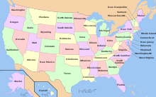
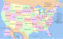
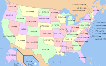
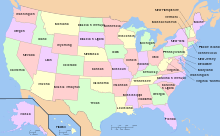
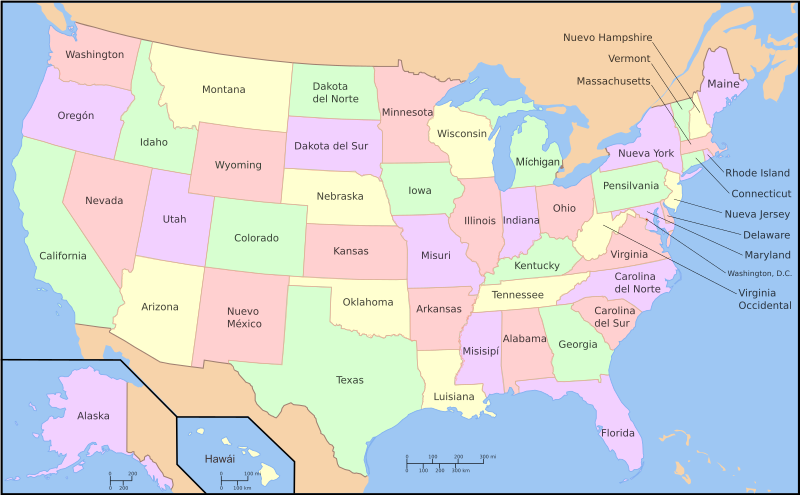
Español: Mapa de los es:Estados Unidos incluyendo los nombres de los estados en español. Esta imagen fue derivada y traducida por User:Szyslak de la imagen Image:Map of USA with state names.svg. La información en español fue del artículo es:Estado de los Estados Unidos.
Un mapa de los es:Estados Unidos con los nombres de los estados. El original fue editado por User:Andrew c para incluir Nova Scotia, PEI, Bahamas, y la clave.
Originalmente fue subida a Wikipedia en inglés con el mismo titulo por w:User:Wapcaplet
English: This is a map of the w:United States with the w:U.S. state names in Spanish. This is a derivative work of Image:Map of USA with state names.svg, translated by User:Szyslak, based on es:Estado de los Estados Unidos.
Fecha 26 de septiembre de 2007 (fecha original de carga)
Fuente No se ha podido leer automáticamente información sobre la fuente; se asume que es trabajo propio (según los derechos de autor reclamados).
Autor No se ha podido leer automáticamente información sobre el autor; se asume que es Szyslak (según los derechos de autor reclamados).
Otras versiones Este archivo deriva de: Map of USA with state names.svg
  • 20:57, 9 October 2005 . . Dbenbenn . . 959x593 (339217 bytes) (fix South Carolina label)
  • 20:27, 9 October 2005 . . Dbenbenn . . 959x593 (339227 bytes) (typo, Massachussetts -> Massachusetts)
  • 19:01, 9 October 2005 . . Dbenbenn . . 959x593 (371653 bytes) (crop, and remove some shapes (rivers, highways, capitals, lakes) that didn't display anyway)
  • 13:18, 23 September 2005 . . Ed g2s . . 990x855 (978668 bytes) (fix (removed <image /> tag))
  • 23:48, 23 September 2004 . . Wapcaplet . . 0x0 (978926 bytes) (SVG map of the United States. Created by Wapcaplet. {{GFDL}})

Licencia

Yo, titular de los derechos de autor de esta obra, la publico en los términos de las siguientes licencias:
GNU head Se autoriza la copia, distribución y modificación de este documento bajo los términos de la licencia de documentación libre GNU, versión 1.2 o cualquier otra que posteriormente publique la Fundación para el Software Libre; sin secciones invariables, textos de portada, ni textos de contraportada. Se incluye una copia de la dicha licencia en la sección titulada Licencia de Documentación Libre GNU.
w:es:Creative Commons
atribución compartir igual
Este archivo se encuentra bajo la licencia Creative Commons Attribution-Share Alike 3.0 Unported, 2.5 Generic, 2.0 Generic and 1.0 Generic
Eres libre:
  • de compartir – de copiar, distribuir y transmitir el trabajo
  • de remezclar – de adaptar el trabajo
Bajo las siguientes condiciones:
  • atribución – Debes otorgar el crédito correspondiente, proporcionar un enlace a la licencia e indicar si realizaste algún cambio. Puedes hacerlo de cualquier manera razonable pero no de manera que sugiera que el licenciante te respalda a ti o al uso que hagas del trabajo.
  • compartir igual – En caso de mezclar, transformar o modificar este trabajo, deberás distribuir el trabajo resultante bajo la misma licencia o una compatible como el original.
Puedes usar la licencia que prefieras.

[editar]

Multilingual
Map of USA with state names.svg|lang=af (afrikáans)
Map of USA with state names.svg|lang=am (amárico)
Map of USA with state names.svg|lang=ang (inglés antiguo)
Map of USA with state names.svg|lang=an (aragonés)
Map of USA with state names.svg|lang=arc (arameo)
Map of USA with state names.svg|lang=ar (árabe)
Map of USA with state names.svg|lang=arz (Egyptian Arabic)
Map of USA with state names.svg|lang=ast (asturiano)
Map of USA with state names.svg|lang=ay (aimara)
Map of USA with state names.svg|lang=az (azerbaiyano)
Map of USA with state names.svg|lang=bar (Bavarian)
Map of USA with state names.svg|lang=ba (baskir)
Map of USA with state names.svg|lang=bcl (Central Bikol)
Map of USA with state names.svg|lang=be (bielorruso)
Map of USA with state names.svg|lang=bg (búlgaro)
Map of USA with state names.svg|lang=bi (bislama)
Map of USA with state names.svg|lang=bn (bengalí)
Map of USA with state names.svg|lang=bpy (Bishnupriya)
Map of USA with state names.svg|lang=br (bretón)
Map of USA with state names.svg|lang=bs (bosnio)
Map of USA with state names.svg|lang=ca (catalán)
Map of USA with state names.svg|lang=ce (checheno)
Map of USA with state names.svg|lang=ckb (kurdo sorani)
Map of USA with state names.svg|lang=co (corso)
Map of USA with state names.svg|lang=cs (checo)
Map of USA with state names.svg|lang=cu (eslavo eclesiástico)
Map of USA with state names.svg|lang=cv (chuvasio)
Map of USA with state names.svg|lang=cy (galés)
Map of USA with state names.svg|lang=da (danés)
Map of USA with state names.svg|lang=de (alemán)
Map of USA with state names.svg|lang=diq (Zazaki)
Map of USA with state names.svg|lang=el (griego)
Map of USA with state names.svg|lang=eo (esperanto)
Map of USA with state names.svg|lang=es (español)
Map of USA with state names.svg|lang=et (estonio)
Map of USA with state names.svg|lang=eu (euskera)
Map of USA with state names.svg|lang=fa (persa)
Map of USA with state names.svg|lang=fi (finés)
Map of USA with state names.svg|lang=fo (feroés)
Map of USA with state names.svg|lang=frr (frisón septentrional)
Map of USA with state names.svg|lang=fr (francés)
Map of USA with state names.svg|lang=fy (frisón occidental)
Map of USA with state names.svg|lang=gag (gagauzo)
Map of USA with state names.svg|lang=ga (irlandés)
Map of USA with state names.svg|lang=gd (gaélico escocés)
Map of USA with state names.svg|lang=gl (gallego)
Map of USA with state names.svg|lang=gn (guaraní)
Map of USA with state names.svg|lang=gv (manés)
Map of USA with state names.svg|lang=hak (chino hakka)
Map of USA with state names.svg|lang=haw (hawaiano)
Map of USA with state names.svg|lang=he (hebreo)
Map of USA with state names.svg|lang=hif (Fiji Hindi)
Map of USA with state names.svg|lang=hi (hindi)
Map of USA with state names.svg|lang=hr (croata)
Map of USA with state names.svg|lang=ht (criollo haitiano)
Map of USA with state names.svg|lang=hu (húngaro)
Map of USA with state names.svg|lang=hy (armenio)
Map of USA with state names.svg|lang=ia (interlingua)
Map of USA with state names.svg|lang=id (indonesio)
Map of USA with state names.svg|lang=ie (interlingue)
Map of USA with state names.svg|lang=ig (igbo)
Map of USA with state names.svg|lang=ik (inupiaq)
Map of USA with state names.svg|lang=ilo (ilocano)
Map of USA with state names.svg|lang=io (ido)
Map of USA with state names.svg|lang=is (islandés)
Map of USA with state names.svg|lang=it (italiano)
Map of USA with state names.svg|lang=ja (japonés)
Map of USA with state names.svg|lang=jv (javanés)
Map of USA with state names.svg|lang=kab (cabileño)
Map of USA with state names.svg|lang=ka (georgiano)
Map of USA with state names.svg|lang=kk (kazajo)
Map of USA with state names.svg|lang=kn (canarés)
Map of USA with state names.svg|lang=ko (coreano)
Map of USA with state names.svg|lang=krc (karachay-balkar)
Map of USA with state names.svg|lang=ku (kurdo)
Map of USA with state names.svg|lang=kw (córnico)
Map of USA with state names.svg|lang=lad (ladino)
Map of USA with state names.svg|lang=la (latín)
Map of USA with state names.svg|lang=lez (lezgiano)
Map of USA with state names.svg|lang=lij (Ligurian)
Map of USA with state names.svg|lang=li (limburgués)
Map of USA with state names.svg|lang=lmo (lombardo)
Map of USA with state names.svg|lang=lt (lituano)
Map of USA with state names.svg|lang=lv (letón)
Map of USA with state names.svg|lang=mg (malgache)
Map of USA with state names.svg|lang=mhr (Eastern Mari)
Map of USA with state names.svg|lang=mi (maorí)
Map of USA with state names.svg|lang=mk (macedonio)
Map of USA with state names.svg|lang=ml (malayálam)
Map of USA with state names.svg|lang=mn (mongol)
Map of USA with state names.svg|lang=mrj (Western Mari)
Map of USA with state names.svg|lang=mr (maratí)
Map of USA with state names.svg|lang=ms (malayo)
Map of USA with state names.svg|lang=my (birmano)
Map of USA with state names.svg|lang=mzn (mazandaraní)
Map of USA with state names.svg|lang=nah (Nāhuatl)
Map of USA with state names.svg|lang=nds (bajo alemán)
Map of USA with state names.svg|lang=ne (nepalí)
Map of USA with state names.svg|lang=new (nevarí)
Map of USA with state names.svg|lang=nl (neerlandés)
Map of USA with state names.svg|lang=nn (noruego nynorsk)
Map of USA with state names.svg|lang=no (noruego)
Map of USA with state names.svg|lang=nv (navajo)
Map of USA with state names.svg|lang=oc (occitano)
Map of USA with state names.svg|lang=or (oriya)
Map of USA with state names.svg|lang=os (osético)
Map of USA with state names.svg|lang=pam (pampanga)
Map of USA with state names.svg|lang=pap (papiamento)
Map of USA with state names.svg|lang=pa (punyabí)
Map of USA with state names.svg|lang=pi (pali)
Map of USA with state names.svg|lang=pl (polaco)
Map of USA with state names.svg|lang=pms (Piedmontese)
Map of USA with state names.svg|lang=pnb (Western Punjabi)
Map of USA with state names.svg|lang=pt (portugués)
Map of USA with state names.svg|lang=qu (quechua)
Map of USA with state names.svg|lang=rm (romanche)
Map of USA with state names.svg|lang=ro (rumano)
Map of USA with state names.svg|lang=ru (ruso)
Map of USA with state names.svg|lang=sa (sánscrito)
Map of USA with state names.svg|lang=sah (sakha)
Map of USA with state names.svg|lang=scn (siciliano)
Map of USA with state names.svg|lang=sco (escocés)
Map of USA with state names.svg|lang=sc (sardo)
Map of USA with state names.svg|lang=se (sami septentrional)
Map of USA with state names.svg|lang=sh (serbocroata)
Map of USA with state names.svg|lang=sk (eslovaco)
Map of USA with state names.svg|lang=sl (esloveno)
Map of USA with state names.svg|lang=sq (albanés)
Map of USA with state names.svg|lang=sr (serbio)
Map of USA with state names.svg|lang=sv (sueco)
Map of USA with state names.svg|lang=sw (suajili)
Map of USA with state names.svg|lang=ta (tamil)
Map of USA with state names.svg|lang=te (telugu)
Map of USA with state names.svg|lang=th (tailandés)
Map of USA with state names.svg|lang=tl (tagalo)
Map of USA with state names.svg|lang=tr (turco)
Map of USA with state names.svg|lang=tt (tártaro)
Map of USA with state names.svg|lang=ug (uigur)
Map of USA with state names.svg|lang=uk (ucraniano)
Map of USA with state names.svg|lang=ur (urdu)
Map of USA with state names.svg|lang=uz (uzbeko)
Map of USA with state names.svg|lang=vec (Venetian)
Map of USA with state names.svg|lang=vi (vietnamita)
Map of USA with state names.svg|lang=vo (volapük)
Map of USA with state names.svg|lang=war (waray)
Map of USA with state names.svg|lang=wuu (chino wu)
Map of USA with state names.svg|lang=xal (kalmyk)
Map of USA with state names.svg|lang=yi (yidis)
Map of USA with state names.svg|lang=yo (yoruba)
Map of USA with state names.svg|lang=zh (chino)

Leyendas

Añade una explicación corta acerca de lo que representa este archivo

Elementos representados en este archivo

representa a

Historial del archivo

Haz clic sobre una fecha y hora para ver el archivo tal como apareció en ese momento.

Fecha y horaMiniaturaDimensionesUsuarioComentario
actual08:45 30 ene 2013Miniatura de la versión del 08:45 30 ene 2013959 × 593 (407 kB)FuradoArreglando un problema con las fuentes en los nombres de dos estados.
08:03 28 ene 2013Miniatura de la versión del 08:03 28 ene 2013959 × 593 (714 kB)FuradoAñadidos dos acentos (Hawái y Míchigan) de acuerdo con la ortografía de la Real Academia Española.
23:00 26 sep 2007Miniatura de la versión del 23:00 26 sep 2007959 × 593 (721 kB)Szyslaktrying again, this time with consistent fonts - aside from working around my computer not having the document's original font, converting text to paths accounts for any (rare) case where a computer doesn't support Spanish accents
11:29 26 sep 2007Miniatura de la versión del 11:29 26 sep 2007959 × 593 (383 kB)Szyslakconverted all text objects into paths for consistent appearance, fixed accent error on Hawaii (Hawaí)
10:56 26 sep 2007Miniatura de la versión del 10:56 26 sep 2007959 × 593 (383 kB)Szyslakconverted double-line text objects to paths - hopefully this will preserve the original typeface, which my computer apparently doesn't have
10:27 26 sep 2007Miniatura de la versión del 10:27 26 sep 2007959 × 593 (330 kB)Szyslakchanged flow text to plain text
09:56 26 sep 2007Miniatura de la versión del 09:56 26 sep 2007959 × 593 (330 kB)Szyslak===Español=== Un mapa de los eswiki:Estados Unidos incluyendo los nombres de los estados en español. Este imagen fue derivado y traducido por User:Szyslak del imagen Image:Map of USA with state names.svg. La información en español fue del

Uso global del archivo

Las wikis siguientes utilizan este archivo:

Metadatos