
Archivo:Lochindaalmap.jpg
No se dispone de una resolución más alta.
Lochindaalmap.jpg (412 × 508 píxeles; tamaño de archivo: 67 kB; tipo MIME: image/jpeg)
| Descripción |
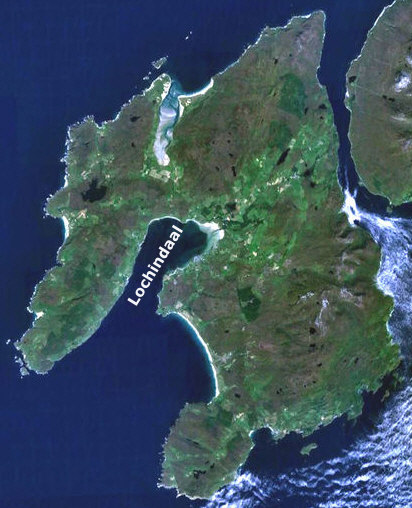
English: adapted from Image:Wfm islay landsat.jpg from the wikipedia commons
URL http://commons.wikimedia.org/wiki/Image:Wfm_islay_landsat.jpg the image has been cropped to include only Islay and the label has been added |
| Fuente | Satellite imagery taken from NASA World Wind software (by screenshot) |
| Autor | Foto: NASA |
Licencia
| Esta imagen se encuentra en el dominio público porque es una captura de pantalla del software de globo terráqueo de la NASA, World Wind, que utiliza una capa de dominio público, como Blue Marble, MODIS, Landsat, SRTM, USGS o GLOBE.
|
 |
Registro original de carga
Aquí se muestra la página de descripción original. Los siguientes nombres de usuario se refieren a en.wikipedia.
- 2007-01-16 20:34 Rayhusthwaite 412×508× (68298 bytes) adapted from Image:Wfm islay landsat.jpg from the wikipedia commons URL http://commons.wikimedia.org/wiki/Image:Wfm_islay_landsat.jpg the image has been cropped to include only Islay and the label has been added
Historial del archivo
Haz clic sobre una fecha y hora para ver el archivo tal como apareció en ese momento.
| Fecha y hora | Miniatura | Dimensiones | Usuario | Comentario | |
|---|---|---|---|---|---|
| actual | 22:25 15 ene 2010 | | 412 × 508 (67 kB) | File Upload Bot (Magnus Manske) | {{BotMoveToCommons|en.wikipedia|year={{subst:CURRENTYEAR}}|month={{subst:CURRENTMONTHNAME}}|day={{subst:CURRENTDAY}}}} {{Information |Description={{en|adapted from Image:Wfm islay landsat.jpg from the wikipedia commons URL http://commons.wikimedia.org/wi |
Usos del archivo
La siguiente página usa este archivo:
Uso global del archivo
Las wikis siguientes utilizan este archivo:
- Uso en en.wikipedia.org
- Uso en nn.wikipedia.org