
Archivo:Land Use in the Potomac Basin.gif
Tamaño de esta previsualización: 800 × 598 píxeles. Otras resoluciones: 320 × 239 píxeles · 640 × 479 píxeles · 900 × 673 píxeles.
Ver la imagen en su resolución original (900 × 673 píxeles; tamaño de archivo: 232 kB; tipo MIME: image/gif, 0,2s)
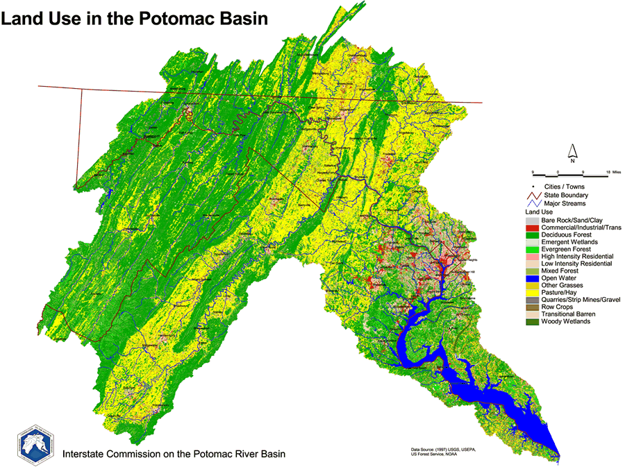
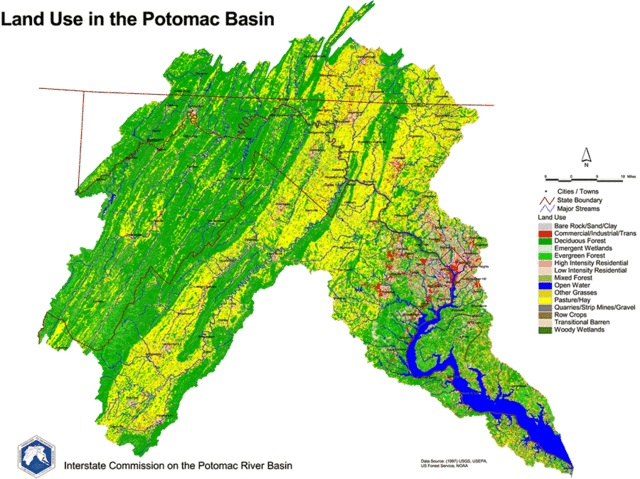
English: 1997 Land Use Map of the Potomac River Basin provided to the public domain by the U.S. Department of the Interior and the U.S. Geological Survey.
Esta imagen está en el dominio público, ya que contiene materiales que originalmente vinieron del Servicio Geológico de los Estados Unidos de América, una agencia del Departamento del Interior. Para obtener más información, consulte la política oficial de derechos de los USGS.
|
Historial del archivo
Haz clic sobre una fecha y hora para ver el archivo tal como apareció en ese momento.
| Fecha y hora | Miniatura | Dimensiones | Usuario | Comentario | |
|---|---|---|---|---|---|
| actual | 19:44 20 mar 2006 | | 900 × 673 (232 kB) | West Virginian | 1997 Land Use Map of the Potomac River Basin provided to the public domain by the U.S. Department of the Interior and the U.S. Geological Survey. {{USGS}} |
Usos del archivo
La siguiente página usa este archivo:
Uso global del archivo
Las wikis siguientes utilizan este archivo:
- Uso en ar.wikipedia.org
- Uso en azb.wikipedia.org
- Uso en de.wikipedia.org
- Uso en el.wikipedia.org
- Uso en en.wikipedia.org
- Uso en gl.wikipedia.org
- Uso en ja.wikipedia.org
- Uso en ko.wikipedia.org
- Uso en la.wikipedia.org