
Archivo:India Chhattisgarh relief map.svg

Tamaño de esta previsualización PNG del archivo SVG: 479 × 600 píxeles. Otras resoluciones: 191 × 240 píxeles · 383 × 480 píxeles · 613 × 768 píxeles · 817 × 1024 píxeles · 1635 × 2048 píxeles · 1152 × 1443 píxeles.
Ver la imagen en su resolución original ((Imagen SVG, nominalmente 1152 × 1443 pixels, tamaño de archivo: 1,73 MB))
Resumen
| Descripción |
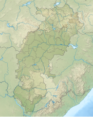
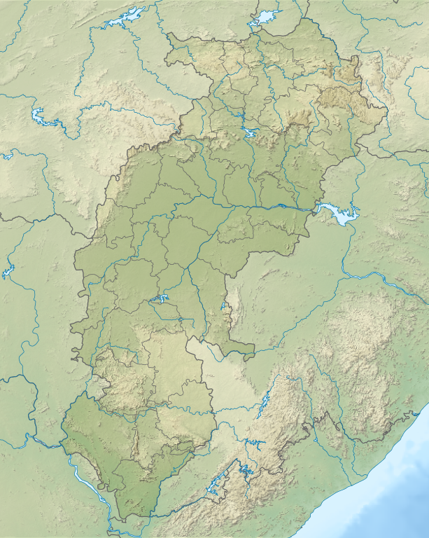
English: Relief map of Chhattisgarh. Relief data from STRM 3 |
| Fecha | |
| Fuente | Derivative of File:India Chhattisgarh location map.svg |
| Autor | Own work based on User:Milenioscuro |
Licencia
Este archivo está disponible bajo la licencia Creative Commons Attribution-Share Alike 4.0 International.
- Eres libre:
- de compartir – de copiar, distribuir y transmitir el trabajo
- de remezclar – de adaptar el trabajo
- Bajo las siguientes condiciones:
- atribución – Debes otorgar el crédito correspondiente, proporcionar un enlace a la licencia e indicar si realizaste algún cambio. Puedes hacerlo de cualquier manera razonable pero no de manera que sugiera que el licenciante te respalda a ti o al uso que hagas del trabajo.
- compartir igual – En caso de mezclar, transformar o modificar este trabajo, deberás distribuir el trabajo resultante bajo la misma licencia o una compatible como el original.
Historial del archivo
Haz clic sobre una fecha y hora para ver el archivo tal como apareció en ese momento.
| Fecha y hora | Miniatura | Dimensiones | Usuario | Comentario | |
|---|---|---|---|---|---|
| actual | 04:52 19 jul 2022 | | 1152 × 1443 (1,73 MB) | C1MM | c Sarangarh dist |
| 05:45 23 abr 2022 |  | 1152 × 1443 (1,72 MB) | C1MM | New districts | |
| 05:12 12 may 2021 |  | 934 × 1286 (1,4 MB) | C1MM | Added better relief and boundaries | |
| 19:25 15 ene 2021 |  | 1613 × 2221 (1,56 MB) | C1MM | Increased colour contrast | |
| 23:53 16 dic 2020 |  | 1613 × 2221 (2,11 MB) | C1MM | Changed colours of the relief map | |
| 05:10 24 oct 2020 |  | 1613 × 2221 (2,04 MB) | C1MM | Fixed colors for relief and added bathymetry | |
| 17:43 21 abr 2020 |  | 1531 × 2221 (2,34 MB) | C1MM | Added rivers | |
| 20:37 20 abr 2020 |  | 1531 × 2221 (2,3 MB) | C1MM | Uploaded a work by Based on Milenoscuro from Own work based on File:India Chhattisgarh location map with UploadWizard |
Usos del archivo
Las siguientes páginas usan este archivo:
Uso global del archivo
Las wikis siguientes utilizan este archivo:
- Uso en bn.wikipedia.org
- Uso en de.wikipedia.org
- Uso en en.wikipedia.org
- Kanger Valley National Park
- Chitrakote Falls
- Achanakmar Wildlife Sanctuary
- Murrum Silli Dam
- Kherkatta Dam
- Bailadila Range
- Mahan Small Hydel Project
- Sirpur Group of Monuments
- Tamda Ghumar
- Mandwa Waterfalls
- Mendri Ghumar
- Module:Location map/data/India Chhattisgarh
- Module:Location map/data/India Chattisgarh
- Module:Location map/data/India Chhattisgarh/doc
- Chhindari Dam
- Uso en fr.wikipedia.org
- Raipur
- Surajpur
- Kanker
- Kawardha
- Bhilai
- Modèle:Géolocalisation/Chhattisgarh
- Centrale de Sipat
- Centrale de Korba
- Mine de Gevra
- Mine de Kusmunda
- Mine de Dipka
- Korba (Inde)
- Durg
- Jagdalpur
- Bilaspur (Chhattisgarh)
- Ambikapur
- Balrampur (Chhattisgarh)
- Kondagaon
- Mungeli
- Baloda Bazar
- Dhamtari
- Jashpur Nagar
- Baikunthpur (Koriya)
- Mahasamund
- Rajnandgaon
- Balod
- Naila Janjgir
Ver más uso global de este archivo.