
Archivo:Hurricane Katrina wind swath.gif
Ver la imagen en su resolución original (895 × 716 píxeles; tamaño de archivo: 29 kB; tipo MIME: image/gif)
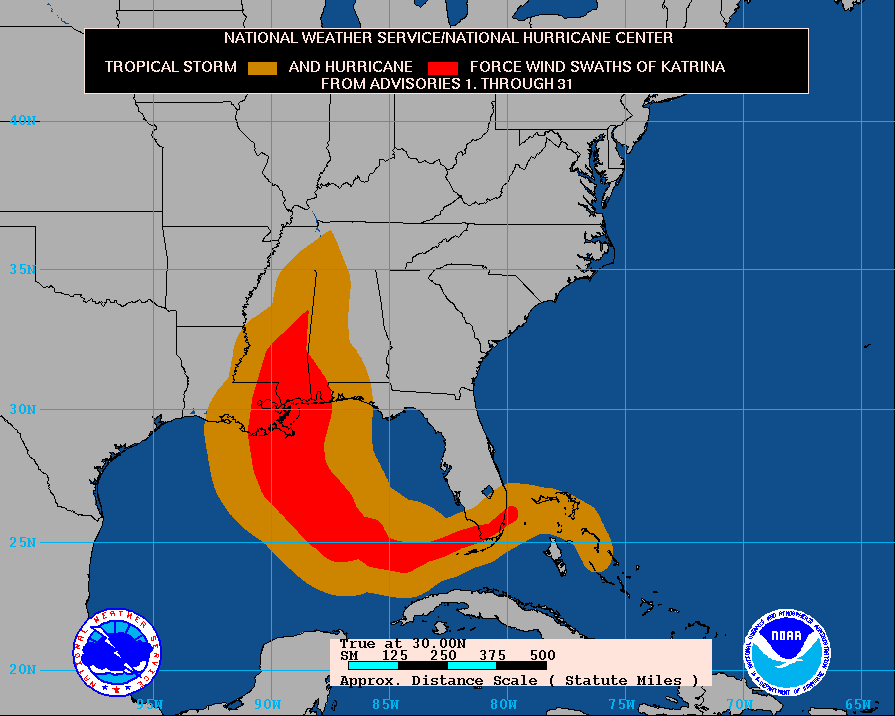
Tropical Storm KATRINA - Cumulative wind distribution
From data release #31 issued 10 AM CDT, 30 August, 2005 by National Hurricane Center Website
Resumen
The path of Hurricane Katrina, obtained from http://www.nhc.noaa.gov/archive/2005/graphics/AT12/31.AL1205S.GIF
This display shows how the size of the storm has changed, and the areas potentially affected so far by sustained winds of tropical storm force (in orange) and hurricane force (in red). The display is based on the wind radii contained in the set of Forecast/Advisories indicated at the top of the figure. Users are reminded that the Forecast/Advisory wind radii represent the maximum possible extent of a given wind speed within particular quadrants around the tropical cyclone. As a result, not all locations falling within the orange or red swaths will have experienced sustained tropical storm or hurricane force winds, respectively.
Licencia
Esta imagen es de dominio público porque contiene material que vino originalmente de la Administración Nacional Oceánica y Atmosférica de los Estados Unidos de América, recibidas o hechas en el curso de las funciones oficiales de un empleado.
|
Historial del archivo
Haz clic sobre una fecha y hora para ver el archivo tal como apareció en ese momento.
| Fecha y hora | Miniatura | Dimensiones | Usuario | Comentario | |
|---|---|---|---|---|---|
| actual | 15:14 3 sep 2005 | | 895 × 716 (29 kB) | Square87~commonswiki |
Usos del archivo
La siguiente página usa este archivo:
Uso global del archivo
Las wikis siguientes utilizan este archivo:
- Uso en af.wikipedia.org
- Uso en de.wikipedia.org
- Uso en en.wikipedia.org
- Uso en en.wikinews.org
- Uso en ko.wikipedia.org
- Uso en nl.wikipedia.org
- Uso en uk.wikipedia.org