
Archivo:Dalby City of Troy turf maze.jpg
Tamaño de esta previsualización: 800 × 511 píxeles. Otras resoluciones: 320 × 205 píxeles · 640 × 409 píxeles · 1134 × 725 píxeles.
Ver la imagen en su resolución original (1134 × 725 píxeles; tamaño de archivo: 1,05 MB; tipo MIME: image/jpeg)
Resumen
| Descripción |
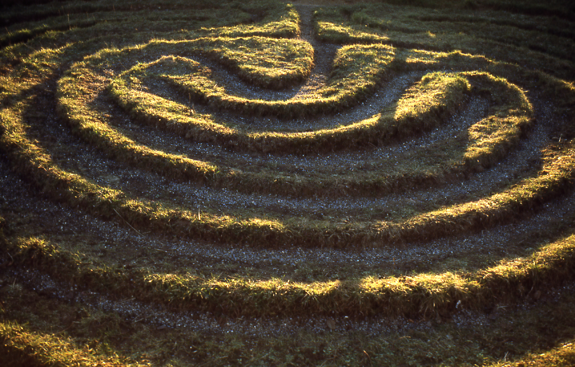
English: City of Troy. The only surviving example in the North Riding of this type of grass maze. It is located by a roadside in the Howardian Hills of Yorkshire, England, near the villages of Dalby, and Skewsby, close to Sheriff Hutton, a few miles north of York.
It is at grid reference SE6252871886 in Bonnygate Lane / High Lane. For some reason neither the Landranger map nor the Victorian Ordnance Survey map mark it. See the Megalithic Portal. Another image from Geograph. |
| Fecha | |
| Fuente | This is a scan of a transparency which I took in the 1970s, scanned and uploaded 8 May 2005. It has been slightly cleaned-up in Photoshop. |
| Autor | User:SiGarb |
| Permiso (Reutilización de este archivo) |
Own work, all rights released. This version of the image is in the Public Domain. If it is used outside Wikipedia, a photographer's credit (Simon Garbutt) would be appreciated! |
| Otras versiones | (I retain the ownership and copyright of the original transparency and any higher-resolution scans derived from it.) SiGarb 18:46, 8 November 2005 (UTC) |
| Posición de la cámara | | Ubicación de esta y otras imágenes en: OpenStreetMap |
|---|
Licencia
| Yo, el titular de los derechos de autor de esta obra, lo libero al dominio público. Esto aplica en todo el mundo. En algunos países esto puede no ser legalmente factible; si ello ocurriese: Concedo a cualquier persona el derecho de usar este trabajo para cualquier propósito, sin ningún tipo de condición al menos que éstas sean requeridas por la ley. |
Historial del archivo
Haz clic sobre una fecha y hora para ver el archivo tal como apareció en ese momento.
| Fecha y hora | Miniatura | Dimensiones | Usuario | Comentario | |
|---|---|---|---|---|---|
| actual | 18:46 8 nov 2005 | | 1134 × 725 (1,05 MB) | SiGarb | This is a scan of a transparency which I took in the 1970s. It has been slightly cleaned-up in Photoshop. It shows "The City of Troy", a roadside turf maze in the Howardian Hills of Yorkshire, England, near the villages of Dalby, and Skewsby, close to S |
Usos del archivo
La siguiente página usa este archivo:
Uso global del archivo
Las wikis siguientes utilizan este archivo:
- Uso en cs.wikipedia.org
- Uso en de.wikipedia.org
- Uso en en.wikipedia.org
- Uso en et.wikipedia.org
- Uso en fi.wikipedia.org
- Uso en gl.wikipedia.org
- Uso en ja.wikipedia.org
- Uso en nl.wikipedia.org
- Uso en ru.wikipedia.org
- Uso en th.wikipedia.org