
Archivo:CSP prospects for the SW USA (3% slopes).jpg
Tamaño de esta previsualización: 784 × 600 píxeles. Otras resoluciones: 314 × 240 píxeles · 628 × 480 píxeles · 1004 × 768 píxeles · 1280 × 979 píxeles · 1583 × 1211 píxeles.
Ver la imagen en su resolución original (1583 × 1211 píxeles; tamaño de archivo: 1,43 MB; tipo MIME: image/jpeg)
| Descripción |
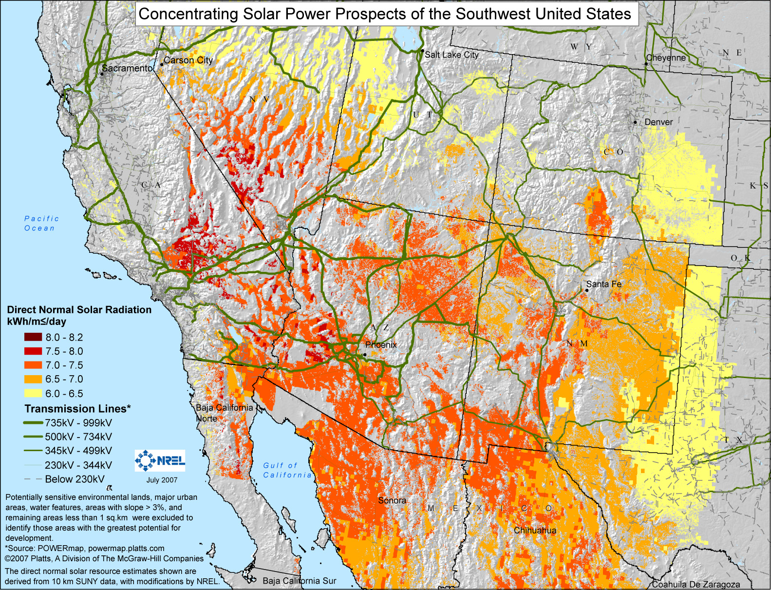
English: Potentially sensitive environmental lands, major urban areas, water features, areas with slope >3%, and remaining areas less than 1 sq.km were excluded to identify those areas with the greatest potential for development. The remaining areas are color-coded for their average isolation, in kW·h/m²/day. |
|||
| Fecha | ||||
| Fuente | http://www.nrel.gov/csp/maps.html#south | |||
| Autor | NREL | |||
| Permiso (Reutilización de este archivo) |
|

.jpg?uselang=es)
Historial del archivo
Haz clic sobre una fecha y hora para ver el archivo tal como apareció en ese momento.
| Fecha y hora | Miniatura | Dimensiones | Usuario | Comentario | |
|---|---|---|---|---|---|
| actual | 22:01 30 may 2009 | | 1583 × 1211 (1,43 MB) | Wwoods | {{Information |Description={{en|1=Potentially sensitive environmental lands, major urban areas, water features, areas with slope >3%, and remaining areas less than 1 sq.km were excluded to identify those areas with the greatest potential for development. |
Usos del archivo
La siguiente página usa este archivo:
Uso global del archivo
Las wikis siguientes utilizan este archivo:
- Uso en ar.wikipedia.org
- Uso en en.wikipedia.org
.jpg)