
Resultados de la búsqueda
Para más opciones de búsqueda, vea Ayuda:Búsqueda.
Quizás quisiste decir: topographic mars
Si consideras que este artículo debería existir, conoces nuestros pilares, dispones de fuentes fiables y sabes indicarlas como referencias, puedes crearlo, opcionalmente usando nuestro asistente.
 topográficos Mapa Topográfico Nacional de España (MTN50, a escala 1:50.000, y MTN25, a escala 1:25.000) Datos: Q216526 Multimedia: Topographic maps / Q216526…3 kB (321 palabras) - 23:50 24 may 2024
 largo del Hintergrauspitz (Schwarzhorn). Retrieved from the Swisstopo topographic maps. The key col is the Chlei Furgga (2,246 m). Datos: Q665000 Multimedia:…1 kB (48 palabras) - 17:38 27 mar 2023
 prominencia de 15 metros.[1] Approximation. Retrieved from the Swisstopo topographic maps and Google Earth. The key col is located south of the summit at 3,980…975 bytes (84 palabras) - 22:24 11 feb 2023
 Gottlieb Studer y su equipo en 1864. Retrieved from the swisstopo topographic maps. The key col is the Grünhornlücke (3,280 m). Lista de montañas de los…1 kB (136 palabras) - 14:52 5 dic 2020
 la primera versión y la última). (maps 1, 2, 3, 6, 7 & 8) 1:50 000 topographic maps of Essex County, produced by The Department of Natural Resources Datos:…4 kB (337 palabras) - 17:16 9 ene 2024
 Consultado el 29 de agosto de 2023. «The Atlas of Canada - Toporama – Topographic Maps». web.archive.org. 28 de octubre de 2008. Archivado desde el original…2 kB (146 palabras) - 11:45 16 ene 2024
 6 habitantes por kilómetro cuadrado. Retrieved from the Swisstopo topographic maps. The key col is the Blüemlisalpsattel (3,133 m). Datos: Q8001269 Multimedia:…1 kB (163 palabras) - 17:07 10 oct 2023
 «Populated Place Profile (West Virginia)» (en inglés). TopoZone. USGS Topographic Maps. Consultado el 21 de abril de 2024. «Unincorporated Place (West Virginia)»…2 kB (159 palabras) - 23:41 21 abr 2024
 dell'Uomo. Lista de montañas de los Grisones Retrieved from the Swisstopo topographic maps (1:25,000) [1]. The key col is the Fuorcla Vatgira (2,825 m). Wuthrich…3 kB (228 palabras) - 22:23 22 abr 2023
 (el "valle") y fluh (el "pico").[3] Retrieved from the Swisstopo topographic maps. The key col is the Col de Jable (1,884 m). «Gummfluh». Archivado desde…2 kB (243 palabras) - 11:39 2 ene 2024
 Anexo:Carreteras más altas del mundo Retrieved from the Swisstopo topographic maps. Statistic opening period of the pass (german) Swiss Ski resort Oberalp…3 kB (267 palabras) - 22:46 4 feb 2023
 para desviarse luego siguiendo la cadena montañosa en dirección sur. «Topographic maps of Catalonia». Institut Cartogràfic de Catalunya. Consultado el 22…2 kB (221 palabras) - 20:24 18 feb 2023
- la primera versión y la última). (maps 1, 2, 3, 6, 7 & 8) 1:50 000 topographic maps of Essex County, produced by The Department of Natural Resources Datos:…5 kB (571 palabras) - 15:17 22 ene 2024
 Atribución-CompartirIgual 4.0 Internacional. «Detailed topographic map» (JPEG). United States Topographic Maps 1:250,000. University of Texas. 1983. Consultado…7 kB (729 palabras) - 22:25 13 nov 2023
 Atlas of Canadá - Barron River Ontario GeoNames Index - Barron River Topographic Maps of the Barron River Datos: Q808973 Multimedia: Barron River, Ontario…5 kB (323 palabras) - 21:54 3 feb 2021
 afirmaciones, el rumor se ha ido propagando.[7][4][5] Atlas of Antarctica. Topographic Maps from Geostatistical Analysis of Satellite Radar Altimeter Data. Christina…4 kB (430 palabras) - 23:39 9 oct 2023
 Collection, China 1:250,000, Series L500, U.S. Army Map Service, 1954- . Topographic Maps of China during the Second World War. Chang-Chia-K'ou(Kalgan) nk50-10…11 kB (1696 palabras) - 19:58 20 mar 2023
 "Chinese Winter Offensive" (Late Nov 1939 - Late March 1940) Map 19. "Topographic Maps of China during the Second World War". Series L500. Perry–Castañeda…7 kB (825 palabras) - 14:59 8 feb 2023
 http://apps.gov.bc.ca/pub/bcgnws/names/28421.html. «Canadian 1:50K topographic maps» (map). TopoQuest.com. Consultado el 23 de noviembre de 2016. Datos:…6 kB (771 palabras) - 14:19 9 oct 2023
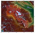
 Stratigraphy and Topography of McMurdo Crater area, Planum Australe, Mars Topographic maps of the Martian South Pole USGS map of Planum Australe Datos: Q1586218…8 kB (906 palabras) - 16:51 14 feb 2024


