
Archivo:USACE John H Kerr Dam and Lake.jpg
Tamaño de esta previsualización: 800 × 533 píxeles. Otras resoluciones: 320 × 213 píxeles · 640 × 427 píxeles · 1024 × 683 píxeles · 1500 × 1000 píxeles.
Ver la imagen en su resolución original (1500 × 1000 píxeles; tamaño de archivo: 651 kB; tipo MIME: image/jpeg)
| Descripción |
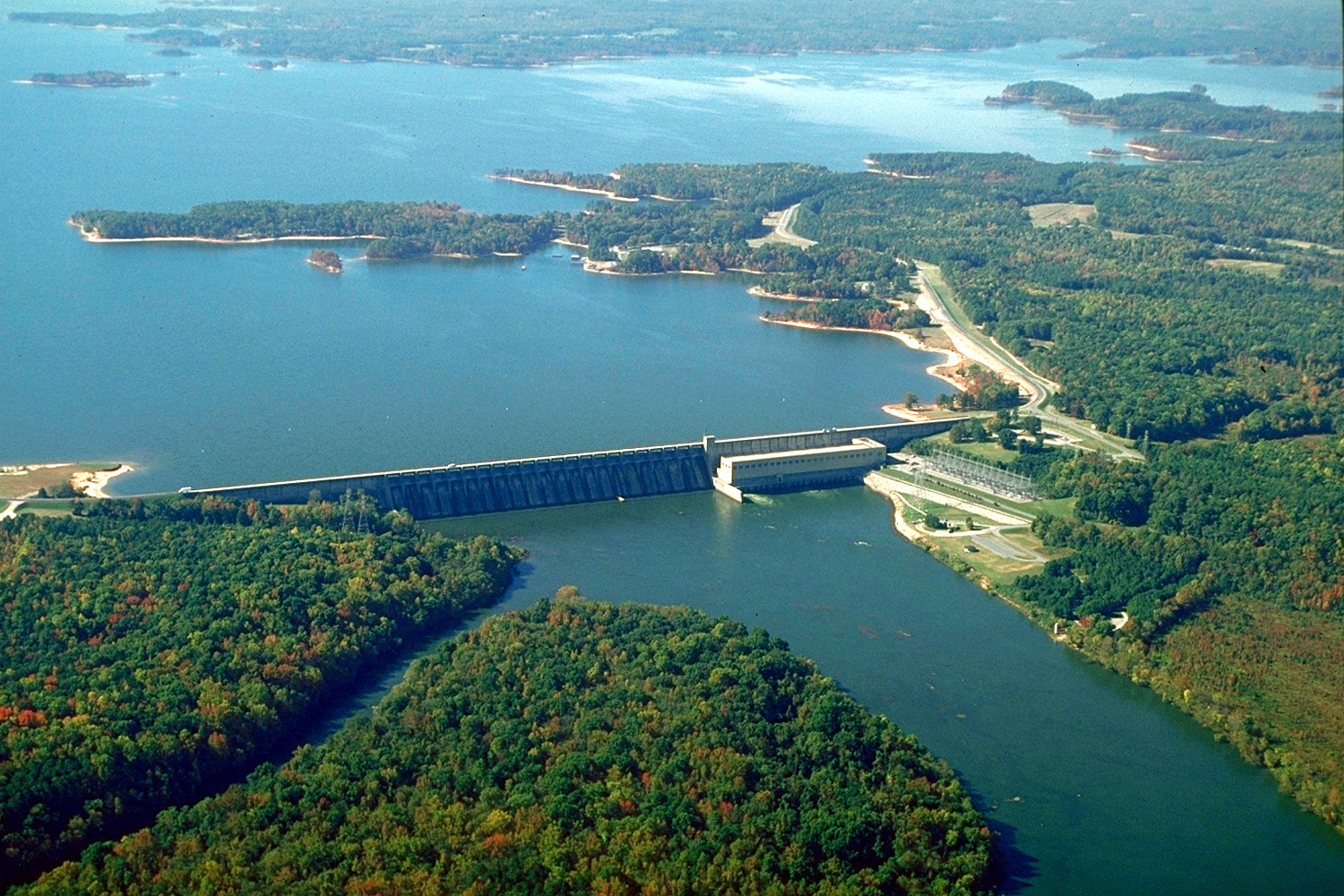
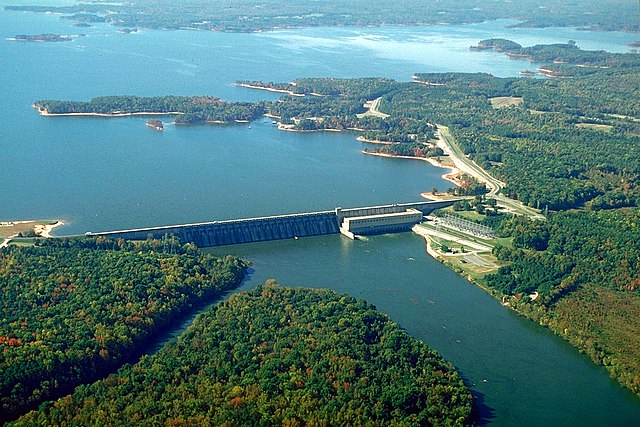
English: The John H. Kerr Dam and Lake on the Roanoke River in Mecklenburg County, Virginia, USA. The U.S. Army Corps of Engineers constructed the dam for flood control on the Roanoke River. View is to the south-southwest.
Coordinates: 36°35′53.76″N 78°17′53.63″W / 36.5982667°N 78.2982306°W |
|||
| Localización | Mecklenburg County, Virginia, USA | |||
| Fecha | (Caveat: Dates provided by U.S. Army Corps of Engineers Digital Visual Library are not reliable and are often wrong.) | |||
| Fuente |
U.S. Army Corps of Engineers Digital Visual Library Image page Image description page Digital Visual Library home page |
|||
| Autor | Bud Davis, U.S. Army Corps of Engineers | |||
| Permiso (Reutilización de este archivo) |
|
Historial del archivo
Haz clic sobre una fecha y hora para ver el archivo tal como apareció en ese momento.
| Fecha y hora | Miniatura | Dimensiones | Usuario | Comentario | |
|---|---|---|---|---|---|
| actual | 04:40 26 abr 2007 | | 1500 × 1000 (651 kB) | DanMS | {{Information | Description = {{en|The John H. Kerr Dam and Lake on the Roanoke River in Mecklenburg County, Virginia, USA. The U.S. Army Corps of Engineers constructed the dam for flood control on the Roanoke River. View is to the south-southwest.}} C |
Usos del archivo
Las siguientes páginas usan este archivo:
Uso global del archivo
Las wikis siguientes utilizan este archivo:
- Uso en ceb.wikipedia.org
- Uso en de.wikipedia.org
- Uso en en.wikipedia.org
- Uso en fr.wikipedia.org
- Uso en ja.wikipedia.org
- Uso en no.wikipedia.org
- Uso en sr.wikipedia.org
- Uso en uk.wikipedia.org
- Uso en www.wikidata.org