
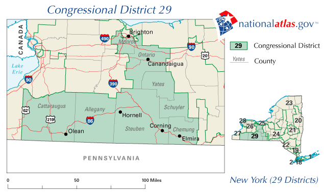
Archivo:United States House of Representatives, New York District 29 map.png
No se dispone de una resolución más alta.
United_States_House_of_Representatives,_New_York_District_29_map.png (635 × 379 píxeles; tamaño de archivo: 25 kB; tipo MIME: image/png)
A map of United States House of Representatives, New York District 29.
The map is from nationalatlas.gov, specifically NY29_109.gif.
This map was obtained from an edition of the National Atlas of the United States. Like almost all works of the U.S. federal government, works from the National Atlas are in the public domain in the United States.
Online access: NationalAtlas.gov | 1970 print edition: Library of Congress, Perry-Castañeda Library
|
Historial del archivo
Haz clic sobre una fecha y hora para ver el archivo tal como apareció en ese momento.
| Fecha y hora | Miniatura | Dimensiones | Usuario | Comentario | |
|---|---|---|---|---|---|
| actual | 21:04 31 mar 2006 | | 635 × 379 (25 kB) | Dbenbenn | PD-USGov-Atlas |
Usos del archivo
La siguiente página usa este archivo:
Uso global del archivo
Las wikis siguientes utilizan este archivo:
- Uso en en.wikipedia.org