
Archivo:USACE Coffeeville Lock and Dam Tombigbee.jpg
Tamaño de esta previsualización: 800 × 534 píxeles. Otras resoluciones: 320 × 214 píxeles · 640 × 428 píxeles · 1024 × 684 píxeles · 1500 × 1002 píxeles.
Ver la imagen en su resolución original (1500 × 1002 píxeles; tamaño de archivo: 769 kB; tipo MIME: image/jpeg)
| Descripción |
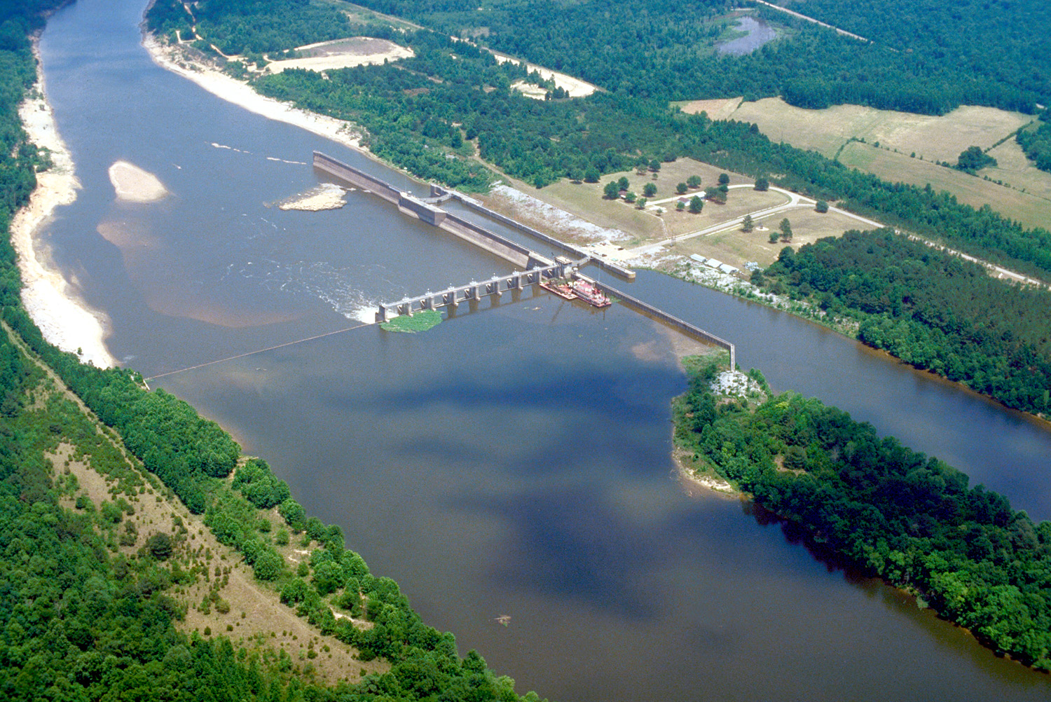
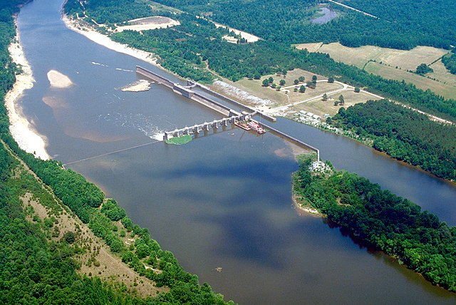
English: Aerial view of Coffeeville Lock and Dam on the Tombigbee River, spanning the border between Choctaw and Clarke Counties near Coffeeville, Alabama, USA. View is downriver to the east. The U.S. Army Corps of Engineers constructed the dam and lock on the river to provide a nine-foot navigation channel. Coffeeville Lock and Dam is the last lock and dam down the Tombigbee River (or the first, if travelling up the Tombigbee or Black Warrior River). There are no locks and dams between Coffeeville and the Gulf of Mexico. |
|||
| Localización | Coffeeville, Alabama, USA 31°45′25.72″N 88°7′44.47″W / 31.7571444°N 88.1290194°W |
|||
| Fecha | ||||
| Fuente |
U.S. Army Corps of Engineers Digital Visual Library Image page Image description page Digital Visual Library home page |
|||
| Autor | U.S. Army Corps of Engineers, photographer not specified or unknown | |||
| Permiso (Reutilización de este archivo) |
|
Historial del archivo
Haz clic sobre una fecha y hora para ver el archivo tal como apareció en ese momento.
| Fecha y hora | Miniatura | Dimensiones | Usuario | Comentario | |
|---|---|---|---|---|---|
| actual | 03:14 19 abr 2007 | | 1500 × 1002 (769 kB) | DanMS | {{Information2 | Description = {{en|Aerial view of Coffeeville Lock and Dam on the Tombigbee River, spanning the border between Choctaw and Clarke Counties near Coffeefille, Alabama, USA. View is downriver to the east. The U.S. Army Corps of Engineers |
Usos del archivo
La siguiente página usa este archivo:
Uso global del archivo
Las wikis siguientes utilizan este archivo:
- Uso en arz.wikipedia.org
- Uso en bg.wikipedia.org
- Uso en ceb.wikipedia.org
- Uso en de.wikipedia.org
- Uso en en.wikipedia.org
- Uso en frr.wikipedia.org
- Uso en fr.wikipedia.org
- Uso en gl.wikipedia.org
- Uso en it.wikipedia.org
- Uso en pl.wikipedia.org
- Uso en ro.wikipedia.org
- Uso en uk.wikipedia.org
- Uso en www.wikidata.org