
Archivo:USACE Black Butte Dam and Lake.jpg

Tamaño de esta previsualización: 800 × 526 píxeles. Otras resoluciones: 320 × 211 píxeles · 640 × 421 píxeles · 1024 × 674 píxeles · 1500 × 987 píxeles.
Ver la imagen en su resolución original (1500 × 987 píxeles; tamaño de archivo: 619 kB; tipo MIME: image/jpeg)
| Descripción |
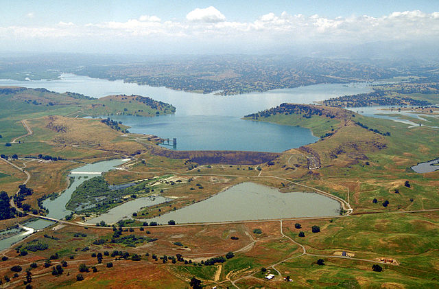
English: Aerial view of Black Butte Dam and Lake in Tehama County, California, USA. The dam was constructed in 1963 for flood control on Stony Creek. The dam is located approximately 9 miles (14.5 km) west of Orland, California.
Coordinates: 39°49′1.17″N 122°20′14.13″W / 39.8169917°N 122.3372583°W |
|||
| Localización | Tehama and Glenn Counties, California, USA | |||
| Fecha | not specified or unknown | |||
| Fuente |
U.S. Army Corps of Engineers Digital Visual Library Image page Image description page Digital Visual Library home page |
|||
| Autor | Michael Nevins, U.S. Army Corps of Engineers | |||
| Permiso (Reutilización de este archivo) |
|
Historial del archivo
Haz clic sobre una fecha y hora para ver el archivo tal como apareció en ese momento.
| Fecha y hora | Miniatura | Dimensiones | Usuario | Comentario | |
|---|---|---|---|---|---|
| actual | 05:47 5 may 2007 | | 1500 × 987 (619 kB) | DanMS | {{Information | Description = {{en|Aerial view of Black Butte Dam and Lake in Tehama County, California, USA. The dam was constructed in 1963 for flood control on Stony Creek. The dam is located approximately 9 miles (15.4 km) west of Orland, Californi |
Usos del archivo
Las siguientes páginas usan este archivo:
Uso global del archivo
Las wikis siguientes utilizan este archivo:
- Uso en ar.wikipedia.org
- Uso en arz.wikipedia.org
- Uso en az.wikipedia.org
- Uso en ceb.wikipedia.org
- Uso en ce.wikipedia.org
- Uso en cs.wikipedia.org
- Uso en cy.wikipedia.org
- Uso en de.wikipedia.org
- Uso en en.wikipedia.org
- Uso en en.wikivoyage.org
- Uso en ga.wikipedia.org
- Uso en hu.wikipedia.org
- Uso en hy.wikipedia.org
- Uso en no.wikipedia.org
- Uso en pl.wikipedia.org
- Uso en pt.wikipedia.org
- Uso en ru.wikipedia.org
- Uso en sr.wikipedia.org
- Uso en tr.wikipedia.org
- Uso en tt.wikipedia.org
- Uso en vi.wikipedia.org
- Uso en www.wikidata.org