
Archivo:Oshima-Oshima island aerial photograph.JPG
Tamaño de esta previsualización: 800 × 592 píxeles. Otras resoluciones: 320 × 237 píxeles · 640 × 474 píxeles · 1024 × 758 píxeles · 1280 × 948 píxeles · 2560 × 1895 píxeles · 4760 × 3524 píxeles.
Ver la imagen en su resolución original (4760 × 3524 píxeles; tamaño de archivo: 9,72 MB; tipo MIME: image/jpeg)
Resumen
| Descripción |
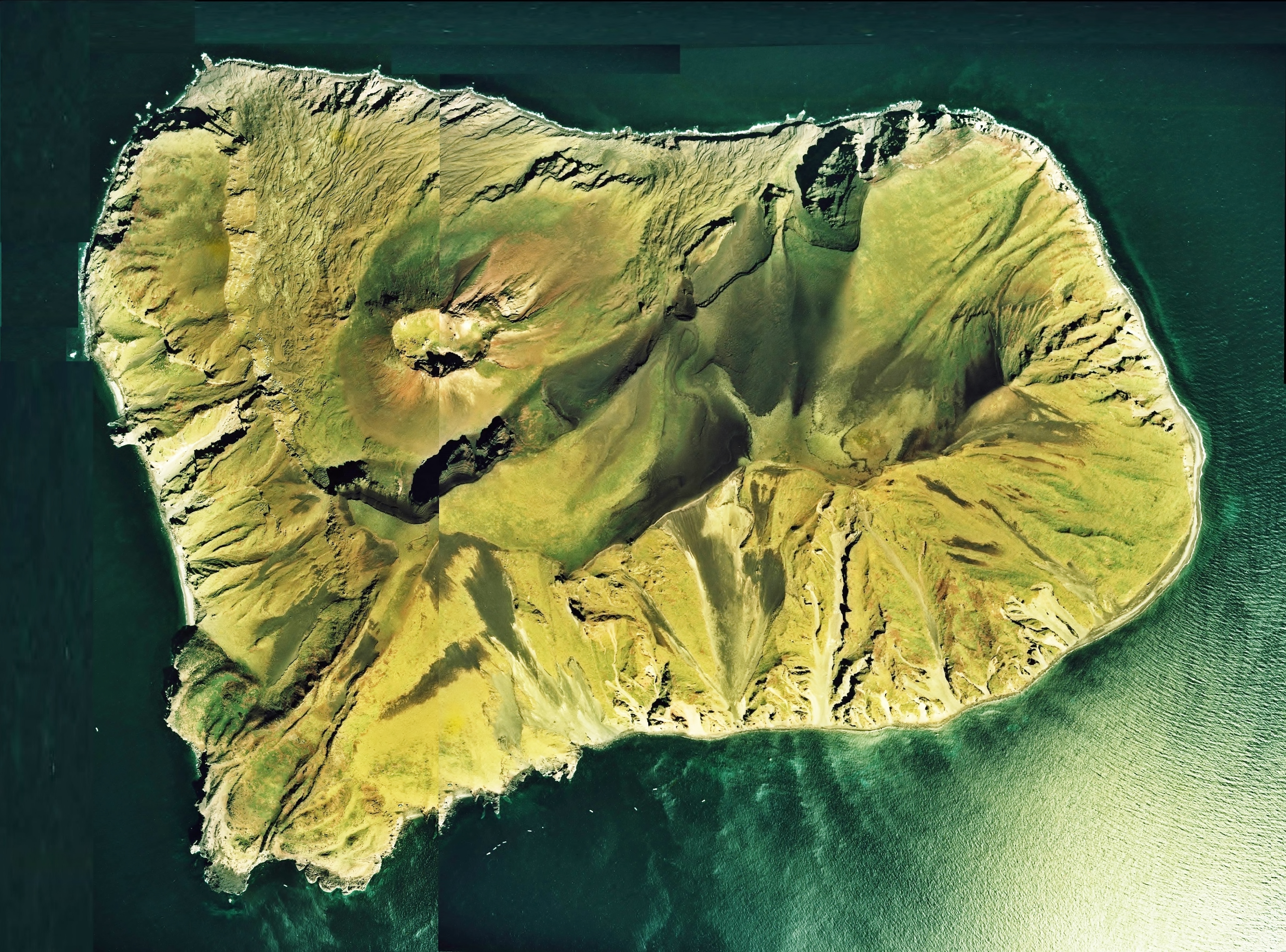
English: Oshima-Oshima island aerial photograph
日本語: 渡島大島(北海道松前町)の空中写真。Cho-76-18_c26_2を使用。 |
| Fecha | |
| Fuente | 国土情報ウェブマッピングシステム |
| Autor | 国土交通省 |
Licencia

|
El propietario de los derechos de autor de este archivo, the Ministry of Land, Infrastructure, Transport and Tourism of Japan, autoriza a cualquier persona a usarlo para cualquier propósito, siempre que el titular de los derechos de autor sea atribuido apropiadamente. La redistribución, la realización de trabajos derivados, el uso comercial y otro tipo de usos están permitidos. |
Atribución:
Copyright © National Land Image Information (Color Aerial Photographs), Ministry of Land, Infrastructure, Transport and Tourism
|
 |
This image is copyrighted by the Ministry of Land, Infrastructure, Transport and Tourism of Japan. For terms of use, see the stipulation to use of National Land Information (in Japanese) and message from MLIT (in Japanese and English). When you display this image on an article, include the following phrase in the description: "Made based on National Land Image Information (Color Aerial Photographs), Ministry of Land, Infrastructure, Transport and Tourism".
|
Historial del archivo
Haz clic sobre una fecha y hora para ver el archivo tal como apareció en ese momento.
| Fecha y hora | Miniatura | Dimensiones | Usuario | Comentario | |
|---|---|---|---|---|---|
| actual | 06:58 8 sep 2013 | | 4760 × 3524 (9,72 MB) | さかおり | Re-create the image of the whole island |
| 04:34 11 dic 2010 |  | 3495 × 3283 (7,38 MB) | さかおり | {{Information |Description={{en|1=Oshima-Oshima island aerial photograph}} {{ja|1=渡島大島(北海道松前町)の空中写真。Cho-76-18_c26_2を使用。}} |Source=国土情報ウェブマッピングシステム |Author=国土交通省 |Date=19 |
Usos del archivo
La siguiente página usa este archivo:
Uso global del archivo
Las wikis siguientes utilizan este archivo:
- Uso en de.wikipedia.org
- Uso en en.wikipedia.org
- Uso en id.wikipedia.org
- Uso en ja.wikipedia.org
- Uso en ko.wikipedia.org
- Uso en uk.wikipedia.org
- Uso en vi.wikipedia.org
- Uso en www.wikidata.org
- Uso en wuu.wikipedia.org
- Uso en zh.wikipedia.org