
Archivo:Abberton and Langenhoe Essex.jpg
No se dispone de una resolución más alta.
Abberton_and_Langenhoe_Essex.jpg (640 × 482 píxeles; tamaño de archivo: 110 kB; tipo MIME: image/jpeg)
Resumen
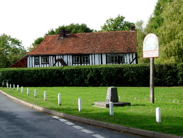
| Descripción | Abberton & Langenhoe Sign. This is a picture of the village sign for the twin villages of Aberton and Langenhoe. These two villages are bisected by the B1025 Mersea Rd to the east of the road is Langenhoe and to the west is Abberton. The stone under the sign is a war memorial, which is unusual in that is was not erected until the year 2000. The photo was taken looking east with the B1025 running north south behind the photographer. |
| Fecha | |
| Fuente | From geograph.org.uk |
| Autor | Glyn Baker |
| Permiso (Reutilización de este archivo) |
Creative Commons Attribution Share-alike license 2.0 |
| Posición de la cámara | | Ubicación de esta y otras imágenes en: OpenStreetMap |
|---|
Licencia

|
Esta imagen proviene de la colección del proyecto Geograph British Isles. Veáse la página de esta fotografía en el sitio web de Geograph para más información del fotógrafo. El titular de los derechos de autor de esta imagen es Glyn Baker y autoriza utilizarla bajo la licencia Reconocimiento-CompartirIgual 2.0 de Creative Commons.
|
Este archivo se encuentra bajo la licencia Creative Commons Genérica de Atribución/Compartir-Igual 2.0.
Atribución: Glyn Baker
- Eres libre:
- de compartir – de copiar, distribuir y transmitir el trabajo
- de remezclar – de adaptar el trabajo
- Bajo las siguientes condiciones:
- atribución – Debes otorgar el crédito correspondiente, proporcionar un enlace a la licencia e indicar si realizaste algún cambio. Puedes hacerlo de cualquier manera razonable pero no de manera que sugiera que el licenciante te respalda a ti o al uso que hagas del trabajo.
- compartir igual – En caso de mezclar, transformar o modificar este trabajo, deberás distribuir el trabajo resultante bajo la misma licencia o una compatible como el original.
Historial del archivo
Haz clic sobre una fecha y hora para ver el archivo tal como apareció en ese momento.
| Fecha y hora | Miniatura | Dimensiones | Usuario | Comentario | |
|---|---|---|---|---|---|
| actual | 21:39 11 may 2009 | | 640 × 482 (110 kB) | Fences and windows | == Summary == {{Information |Description=Abberton & Langenhoe Sign. This is a picture of the village sign for the twin villages of Aberton and Langenhoe. These two villages are bisected by the B1025 Mersea Rd to the east of the road is Langenhoe and to th |
Usos del archivo
La siguiente página usa este archivo:
Uso global del archivo
Las wikis siguientes utilizan este archivo:
- Uso en ceb.wikipedia.org
- Uso en cy.wikipedia.org
- Uso en en.wikipedia.org
- Uso en fr.wikipedia.org
- Uso en lld.wikipedia.org
- Uso en nl.wikipedia.org
- Uso en www.wikidata.org
- Uso en zh-min-nan.wikipedia.org