
Archivo:A PLAN of the HARBOUR and Parts of adjacent on the ISTHMUS of DARIEN where the SCOTCH COMPANY was settled - Justly Watson, 1743 - BL Maps K.Top.124.24.2 (BLL01018640966).jpg

Ver la imagen en su resolución original (6011 × 4385 píxeles; tamaño de archivo: 3,92 MB; tipo MIME: image/jpeg)
| Título |
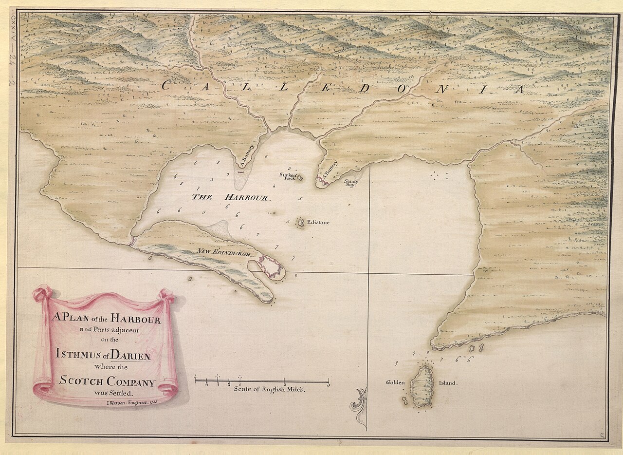
English: A PLAN of the HARBOUR and Parts of adjacent on the ISTHMUS of DARIEN where the SCOTCH COMPANY was settled. / I. Watson: Engineer: 1743. |
|||||||||||||||||||||||
| Descripción |
English: A manuscript map of the Scottish settlement in Caledonia Bay (New Caledonia with New Edinburgh and Fort of St. Andrews), in use 1698-1700. The colony was abandoned in 1700 by remaining survivors of malaria (Encyclopædia Britannica). Includes pinpricks. Includes the bay, the settlement, the fort and batteries. Includes trompe-l'œil title vignette. Oriented with South at the top. Paper bears a watermark of a Roman numerical: "IV". Relief shown pictorially and with soundings. |
|||||||||||||||||||||||
| Fecha | ||||||||||||||||||||||||
| Fuente |
Part of King George III's Topographical Collection. Donated to the nation by George IV. Please do not overwrite this file. Any cropped or modified version should be uploaded with a new name and linked in the "
|
|||||||||||||||||||||||
| Creador |
Draftsman:
|
|||||||||||||||||||||||
| Permiso (Reutilización de este archivo) |
|
|||||||||||||||||||||||
| Geotemporal data | ||||||||||||||||||||||||
| Map location |
El Proyecto Darién |
|||||||||||||||||||||||
| Escala | 1:45 500 | |||||||||||||||||||||||
| Nivel de zoom de OpenStreetMap | 13 | |||||||||||||||||||||||
| Bounding box |
|
|||||||||||||||||||||||
| Georeferencing | If inappropriate please set warp_status = skip to hide. | |||||||||||||||||||||||
| Bibliographic data | ||||||||||||||||||||||||
| Lengua | inglés | |||||||||||||||||||||||
| Lugar de publicación | [England?] : [Justly Watson] | |||||||||||||||||||||||
| Archival data | ||||||||||||||||||||||||
| Colección |
|
|||||||||||||||||||||||
| Número de inventario |
British Library Maps K.Top.124.24.2 |
|||||||||||||||||||||||
| Dimensiones | altura: 34 cm; ancho: 49 cm | |||||||||||||||||||||||
| Metadata note | Initial version of this page based on information from the BL catalogue entry, updated 2017-12-08. Used with permission. Accessed 2018-09-18. | |||||||||||||||||||||||


.jpg?uselang=es)
Historial del archivo
Haz clic sobre una fecha y hora para ver el archivo tal como apareció en ese momento.
| Fecha y hora | Miniatura | Dimensiones | Usuario | Comentario | |
|---|---|---|---|---|---|
| actual | 11:51 22 sep 2018 | | 6011 × 4385 (3,92 MB) | JhealdBot | JhealdBot(6): test upload |
Usos del archivo
La siguiente página usa este archivo:
Uso global del archivo
Las wikis siguientes utilizan este archivo:
- Uso en en.wikipedia.org
.jpg)