
Archivo:110th US Congress House districts color.svg

Tamaño de esta previsualización PNG del archivo SVG: 800 × 482 píxeles. Otras resoluciones: 320 × 193 píxeles · 640 × 386 píxeles · 1024 × 617 píxeles · 1280 × 772 píxeles · 2560 × 1543 píxeles · 2583 × 1557 píxeles.
Ver la imagen en su resolución original ((Imagen SVG, nominalmente 2583 × 1557 pixels, tamaño de archivo: 1,24 MB))
Resumen
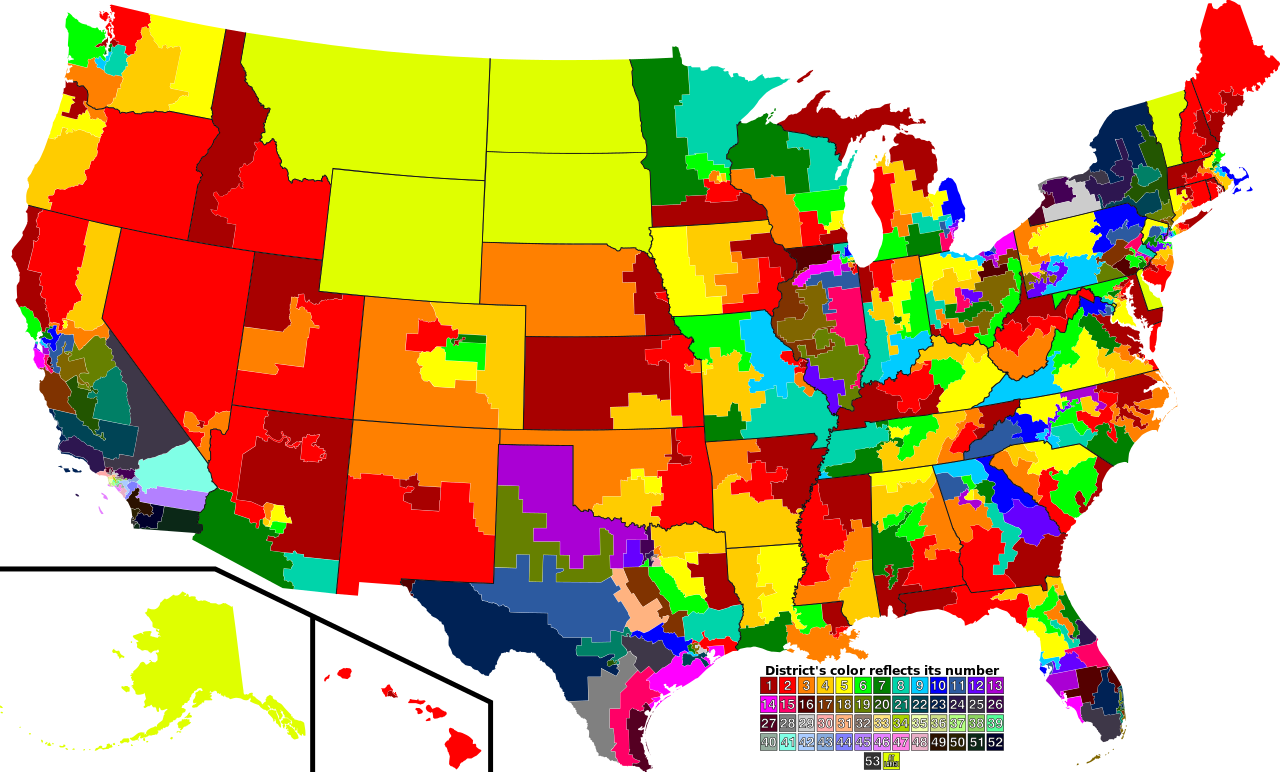
| Descripción | A map of all of the U.S. congressional districts (as of the 110th Congress). To find the district's number, look at the district, compare with the color code at the bottom to get number. |
| Fecha | |
| Fuente | Based off of: [1] for most boundaries, [2] for Georgia, and [3] for Texas. |
| Autor | Mr. Matté (if there is an issue with this image, contact me using this image's Commons talk page, my Commons user talk page, or my English Wikipedia user talk page; I'll know about it a lot faster) |
| Otras versiones |
Obras derivadas de ésta: 113th US Congress House districts color.svg Image:US Congressional districts metro areas.svg (Same as this, but includes large views for urban areas) |
| SVG desarrollo |
![[1]](https://upload.wikimedia.org/wikipedia/commons/archive/2/22/20061111221306%21US_House_Winning_Margins.png)
Legend of map colors:
1st District
|
2nd District
|
3rd District
|
4th District
|
5th District
|
6th District
|
7th District
|
8th District
|
9th District
|
10th District
|
11th District
|
12th District
|
13th District
|
14th District
|
15th District
|
16th District
|
17th District
|
18th District
|
19th District
|
20th District
|
21st District
|
22nd District
|
23rd District
|
24th District
|
25th District
|
26th District
|
27th District
|
28th District
|
29th District
|
30th District
|
31st District
|
32nd District
|
33rd District
|
34th District
|
35th District
|
36th District
|
37th District
|
38th District
|
39th District
|
40th District
|
41st District
|
42nd District
|
43rd District
|
44th District
|
45th District
|
46th District
|
47th District
|
48th District
|
49th District
|
50th District
|
51st District
|
52nd District
|
53rd District
|
At-large District
|
Licencia
| Yo, el titular de los derechos de autor de esta obra, lo libero al dominio público. Esto aplica en todo el mundo. En algunos países esto puede no ser legalmente factible; si ello ocurriese: Concedo a cualquier persona el derecho de usar este trabajo para cualquier propósito, sin ningún tipo de condición al menos que éstas sean requeridas por la ley. |
Historial del archivo
Haz clic sobre una fecha y hora para ver el archivo tal como apareció en ese momento.
| Fecha y hora | Miniatura | Dimensiones | Usuario | Comentario | |
|---|---|---|---|---|---|
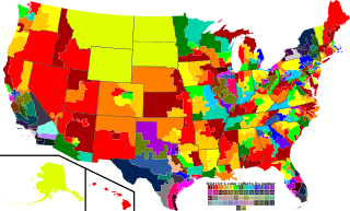
| actual | 22:28 14 sep 2009 | | 2583 × 1557 (1,24 MB) | Mr. Matté | Fix western CA districts |
| 15:45 17 jul 2009 |  | 2583 × 1557 (1,22 MB) | Mr. Matté | Fix NY 26/27, make one path --> text | |
| 02:52 21 ago 2008 |  | 2583 × 1557 (1,25 MB) | Mr. Matté | Fix Hawaii | |
| 02:38 16 abr 2008 |  | 2583 × 1557 (1,3 MB) | Mr. Matté | Higher-quality, smaller version of the colored congressional map by district number | |
| 23:06 6 feb 2008 |  | 9111 × 5493 (1,87 MB) | Mr. Matté | {{Information |Description=A map of all of the U.S. congressional districts (as of the 110th Congress). To find the district's number, look at the district, compar |
Usos del archivo
La siguiente página usa este archivo:
Uso global del archivo
Las wikis siguientes utilizan este archivo:
- Uso en ca.wikipedia.org