
Archivo:Gwisho culture map.png
No se dispone de una resolución más alta.
Gwisho_culture_map.png (326 × 349 píxeles; tamaño de archivo: 13 kB; tipo MIME: image/png)
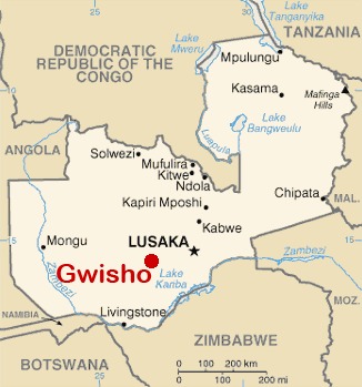
| Descripción | Location of remains of Gwisho Culture (2800-1700 BCE), near Lonchibar national Park, Kafue river | ||
| Fecha | |||
| Fuente | Self work usin the bassis map Image:Zambia-CIA WFB Map.png | ||
| Autor | José-Manuel Benito Álvarez —> Locutus Borg | ||
| Permiso (Reutilización de este archivo) |
|
Historial del archivo
Haz clic sobre una fecha y hora para ver el archivo tal como apareció en ese momento.
| Fecha y hora | Miniatura | Dimensiones | Usuario | Comentario | |
|---|---|---|---|---|---|
| actual | 20:53 1 dic 2017 | | 326 × 349 (13 kB) | Ras67 | cropped and optimized |
| 11:43 9 sep 2006 |  | 330 × 353 (37 kB) | Locutus Borg | {{Information |Description= Location of remains of Gwisho Culture (2800-1700 BCE), near Lonchibar national Park, Kafue river |Source= Self work usin the bassis map Image:Zambia-CIA WFB Map.png |Date= september 9, 2006 |Author= José-Manuel Benito Ál |
Usos del archivo
La siguiente página usa este archivo: