
Archivo:Mapa Ilustrado de la Republica Mexicana Publicado Por Margaret M. Crane Eugenio Fischgrund.jpg

Ver la imagen en su resolución original (3300 × 2092 píxeles; tamaño de archivo: 1,97 MB; tipo MIME: image/jpeg)
Resumen
| Descripción |
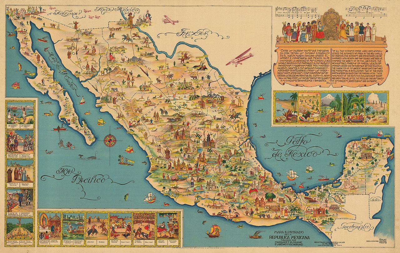
English: By: Miguel Gómez Medina
Date: 1930s (circa) Mexico Dimensions: 19.75 x 23 inches (50.2 x 58.4 cm) This is an exuberant 1930s pictorial map of Mexico designed to entice tourists to explore the many natural, historic, and cultural attractions of the country. The map was created by Miguel G. Medina, and published by Margaret M. Crane & Eugenio Fischgrund. This pictorial map of Mexico is divided by states with railroad lines extending across the country in all directions. Traditional cartographic elements are replaced by imagery of various locals using colors that allow them to blend in and out from one another. In the lower right corner, inset images depict the history of Mexico as well as Mexican customs and traditions. Such insets include the Founding of Mexico in 1325, Conquest of Mexico by Cortes in 1531, Independence of Mexico in September 16, 1810, a Rodeo, Cock-Fight, Bull Fight, and the National Dance, to name a few. A large inset fills the Gulf of Mexico and features the chorus of the national anthem of Mexico, numerous figures in indigenous garb, and a quote from the beginning of the volume on Mexico from William H. Prescott's historical series "The Nations of the World." The map was created by Miguel Gomez Medina and was given to tourists at various hotels and restaurants in Mexico City. Several versions of this map were published: larger versions in both English and Spanish and a smaller version that appeared several years later. This is the large Spanish version, with the addition of 6 planes added just across the border in the United States. |
| Fecha | años 1930 |
| Fuente | Trabajo propio |
| Autor | New World Cartographic |
Licencia
- Eres libre:
- de compartir – de copiar, distribuir y transmitir el trabajo
- de remezclar – de adaptar el trabajo
- Bajo las siguientes condiciones:
- atribución – Debes otorgar el crédito correspondiente, proporcionar un enlace a la licencia e indicar si realizaste algún cambio. Puedes hacerlo de cualquier manera razonable pero no de manera que sugiera que el licenciante te respalda a ti o al uso que hagas del trabajo.
- compartir igual – En caso de mezclar, transformar o modificar este trabajo, deberás distribuir el trabajo resultante bajo la misma licencia o una compatible como el original.
Historial del archivo
Haz clic sobre una fecha y hora para ver el archivo tal como apareció en ese momento.
| Fecha y hora | Miniatura | Dimensiones | Usuario | Comentario | |
|---|---|---|---|---|---|
| actual | 17:21 1 jul 2020 | | 3300 × 2092 (1,97 MB) | New World Cartographic | Uploaded own work with UploadWizard |
Usos del archivo
La siguiente página usa este archivo:
Uso global del archivo
Las wikis siguientes utilizan este archivo:
- Uso en el.wikipedia.org