
Archivo:Newriverwatershed-1-.jpg

Tamaño de esta previsualización: 464 × 599 píxeles. Otras resoluciones: 186 × 240 píxeles · 372 × 480 píxeles · 595 × 768 píxeles · 793 × 1024 píxeles · 1415 × 1826 píxeles.
Ver la imagen en su resolución original (1415 × 1826 píxeles; tamaño de archivo: 511 kB; tipo MIME: image/jpeg)
Resumen
| Descripción |
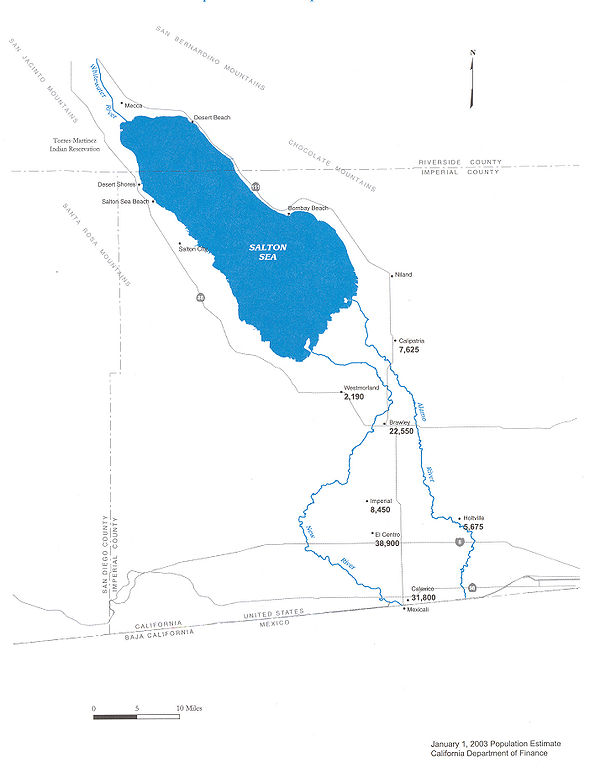
Map of the New River — in Imperial County, Southern California.
|
| Fecha | |
| Fuente | Department of Water Resources |
| Autor | DWR |
| Permiso (Reutilización de este archivo) |
Public use |


Licencia

|
Esta obra tiene derechos de autor. El dueño de los derechos autoriza su utilización sin restricciones, incluyendo todo tipo de redistribución, modificaciones y uso comercial.
Nota: Si es obra tuya, considera usar en su lugar {{PD-self}} . |
Historial del archivo
Haz clic sobre una fecha y hora para ver el archivo tal como apareció en ese momento.
| Fecha y hora | Miniatura | Dimensiones | Usuario | Comentario | |
|---|---|---|---|---|---|
| actual | 09:29 20 may 2006 | | 1415 × 1826 (511 kB) | Cnrc | {{Information| |Description=From Mexicali to the Salton Sea, Communities Are at Risk Surface water in the New River is contaminated with metals, pesticides, VOC's, and bacteria. Pathogenic viruses have also been reported in the New River. Human exposur |
Usos del archivo
Las siguientes páginas usan este archivo:
Uso global del archivo
Las wikis siguientes utilizan este archivo:
- Uso en ar.wikipedia.org
- Uso en arz.wikipedia.org
- Uso en ceb.wikipedia.org
- Uso en de.wikipedia.org
- Uso en en.wikipedia.org
- Uso en eo.wikipedia.org
- Uso en fr.wikipedia.org
- Uso en he.wikipedia.org
- Uso en ja.wikipedia.org
- Uso en ml.wikipedia.org
- Uso en pt.wikipedia.org
- Uso en ru.wikipedia.org
- Uso en simple.wikipedia.org
- Uso en www.wikidata.org