
Archivo:Levant 01.PNG
Ver la imagen en su resolución original (707 × 839 píxeles; tamaño de archivo: 82 kB; tipo MIME: image/png)

|
File:Kingdoms of Israel and Judah map 830.svg es una versión vectorial de este archivo. Debería usarse esa versión en lugar de este archivo PNG.
File:Levant 01.PNG → File:Kingdoms of Israel and Judah map 830.svg
Para más información, lee Ayuda:SVG. |
 |

|
This map has been uploaded by Electionworld from en.wikipedia.org to enable the |
Resumen
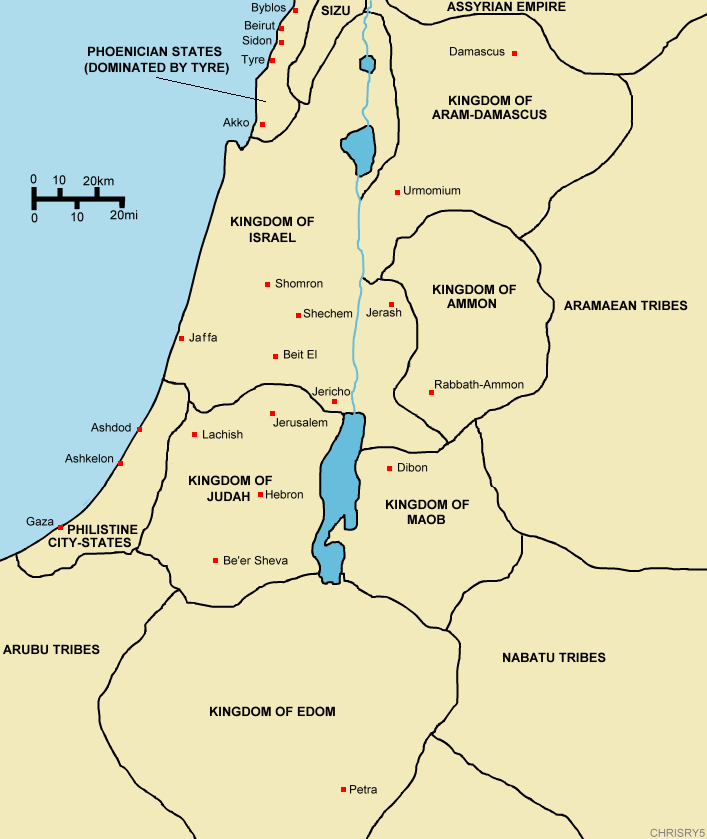
Created by ChrisRy5 using Macromedia Flash. City locations found on Wikipedia.
Map showing the ancient levant borders and ancient cities such as Urmomium and Jerash. The map also shows the region in the 9th century BCE. Notice the coastal land of Philistia, from which the name "Palestine" derives.
Correction: The kingdom to the east of the Dead Sea should be labeled the Kingdom of Moab.
Licencia
| Este trabajo ha sido liberado al dominio público por su autor, ChrisRy5. Esto aplica para todo el mundo. En algunos países esto puede no ser legalmente factible; si ello ocurriese: |
Historial del archivo
Haz clic sobre una fecha y hora para ver el archivo tal como apareció en ese momento.
| Fecha y hora | Miniatura | Dimensiones | Usuario | Comentario | |
|---|---|---|---|---|---|
| actual | 14:53 18 dic 2006 | | 707 × 839 (82 kB) | Electionworld | {{ew|en|ChrisRy5}} == Summary == Created by ChrisRy5 using Macromedia Flash. City locations found on Wikipedia.<BR>Map showing the ancient levant borders and ancient cities such as Urmomium and Jerash. The map also shows the region in the 9th cent |
Usos del archivo
No hay páginas que enlacen a este archivo.
Uso global del archivo
Las wikis siguientes utilizan este archivo:
- Uso en en.wikipedia.org
- Uso en he.wikipedia.org
- Uso en id.wikipedia.org
- Uso en ms.wikipedia.org
- Uso en pl.wikipedia.org
- Uso en sq.wikipedia.org