
Archivo:Grand Union Canal, London-Braunston.png
Tamaño de esta previsualización: 519 × 600 píxeles. Otras resoluciones: 208 × 240 píxeles · 415 × 480 píxeles · 664 × 768 píxeles · 886 × 1024 píxeles · 1772 × 2048 píxeles · 3250 × 3756 píxeles.
Ver la imagen en su resolución original (3250 × 3756 píxeles; tamaño de archivo: 15,85 MB; tipo MIME: image/png)
Resumen
| Descripción |
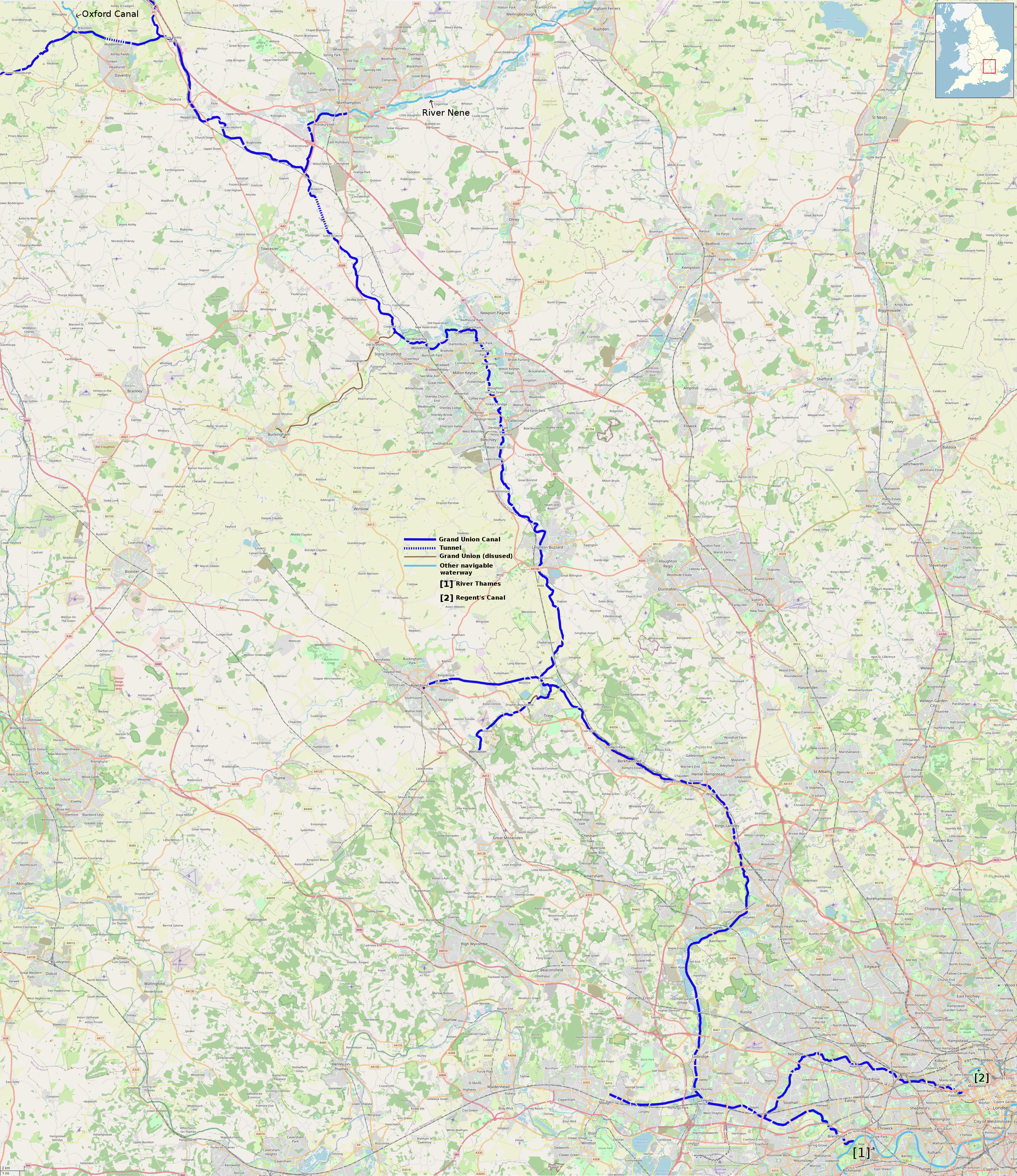
Map of the London to Braunston section of the Grand Union Canal, including all significant arms and branches. Este mapa fue creado con los datos del proyecto OpenStreetMap, obtenidos por la comunidad. Este mapa puede estar incompleto, y puede contener errores. No se fíe solamente en él para las navegaciones. |
|||
| Fecha | ||||
| Fuente | openstreetmap.org | |||
| Creador |
Own work, derived from open street map. OpenStreetMap contributors |
|||
| Permiso (Reutilización de este archivo) |
OpenStreetMap data is available under the Open Database License (details). Standard style map tiles are licensed as ODbL Produced Works.
|
|||
| Georeferencing | If inappropriate please set warp_status = skip to hide. |
Historial del archivo
Haz clic sobre una fecha y hora para ver el archivo tal como apareció en ese momento.
| Fecha y hora | Miniatura | Dimensiones | Usuario | Comentario | |
|---|---|---|---|---|---|
| actual | 09:42 4 may 2022 | | 3250 × 3756 (15,85 MB) | G-13114 | add locator map |
| 00:21 28 abr 2022 |  | 3250 × 3756 (15,88 MB) | G-13114 | {{OpenStreetMap |name = |location = |description = Map of the London to Braunston section of the Grand Union Canal, including all significant arms and branches. |top = |bottom = |left = |right = |date = 2022-04-28 |authors = Own work, derived from open street map. |other_versions = }} Category:Maps produced by User:G-13114 Category:Grand Union Canal Category:OpenStreetMap maps of London Category:OpenStreetMap maps of South East England [[Category:OpenStreetMap maps o... |
Usos del archivo
Las siguientes páginas usan este archivo:
Uso global del archivo
Las wikis siguientes utilizan este archivo:
- Uso en en.wikipedia.org